London’s best views are closely connected to the city’s historic landmarks. St Paul’s Cathedral, Westminster Abbey, the Palace of Westminster, Tower Bridge, the Monument, and the Royal Observatory Greenwich each occupy important positions in London’s architectural and political history.
- Why are London’s best views connected to historic landmarks?
- How did St Paul’s Cathedral become one of London’s defining skyline landmarks?
- What historical story does The Monument reveal about London’s skyline?
- Why does Tower Bridge remain one of London’s most important historic views?
- How did Westminster Abbey and the Palace of Westminster shape London’s historic views?
- Why is Greenwich important to London’s history of science, navigation, and views?
- How does Primrose Hill preserve a historic view of London today?
- How have London’s historic views been protected as the skyline changed?
- What do London’s historic landmarks reveal about the city’s long-term development?
- Frequently Asked Question
The capital’s skyline developed over many centuries. Medieval churches established early visual landmarks. Seventeenth-century rebuilding introduced classical architecture after the Great Fire of 1666. Victorian engineers added bridges, towers, railways, and monumental civic buildings. Modern planning policies now protect important views between historic sites and elevated public spaces.
London’s viewing culture therefore has a historical foundation. A panorama from Primrose Hill, a river prospect toward St Paul’s Cathedral, or a view across the Thames toward Tower Bridge is not simply a scenic experience. Each view connects buildings, streets, waterways, political institutions, scientific achievements, and major episodes of urban change.
The Greater London Authority identifies strategic views including Primrose Hill to Central London, Greenwich Park to Central London, Parliament Hill to Central London, Westminster Pier to St Paul’s Cathedral, King Henry VIII’s Mound to St Paul’s Cathedral, and several protected river prospects. These policies recognise that London’s historic character depends partly on the relationship between landmarks and the spaces from which they are seen.
Understanding the history behind these views provides a more complete picture of London. The landmarks act as fixed reference points while the city surrounding them continues to change.
Why are London’s best views connected to historic landmarks?
London’s best views are connected to historic landmarks because churches, palaces, bridges, monuments, parks, and scientific institutions became permanent visual reference points as the city expanded around them. Protected viewing corridors now preserve important relationships between historic buildings, landscapes, streets, and the River Thames.
London developed around a series of powerful geographical and institutional centres. The River Thames provided a major route for trade and transport. Westminster became associated with monarchy and Parliament. The City of London remained a centre of commerce and administration. Greenwich developed important royal, scientific, and maritime connections.
Tall buildings were historically valuable because they could be identified from long distances. Church towers and spires marked parish centres. St Paul’s Cathedral became one of the most prominent elements of the City skyline after its reconstruction in the late seventeenth and early eighteenth centuries.
The Great Fire of London in 1666 transformed this visual landscape. The fire destroyed much of the medieval City, including approximately 13,000 houses, 87 parish churches, and the medieval St Paul’s Cathedral. The rebuilding programme introduced new buildings, churches, streets, and monuments that reshaped the City’s architectural identity.
The Monument was constructed between 1671 and 1677 to commemorate the Great Fire and the subsequent rebuilding of London. Designed by Christopher Wren and Robert Hooke, it became both a memorial and a prominent viewing structure. Historic England describes it as one of the most significant surviving seventeenth-century monuments of its type.
The nineteenth century added another layer. Population growth, industrialisation, commercial expansion, railway construction, and increased river traffic required new infrastructure. Tower Bridge, completed in 1894, became one of the most recognisable additions to the eastern skyline.
London’s modern planning system now treats views as part of heritage management. The London Plan includes designated strategic views covering central panoramas, linear views, and river prospects. These policies control the effect of new development on important historic landmarks and their settings.
The result is a city where historic architecture and modern development remain visually connected.
How did St Paul’s Cathedral become one of London’s defining skyline landmarks?
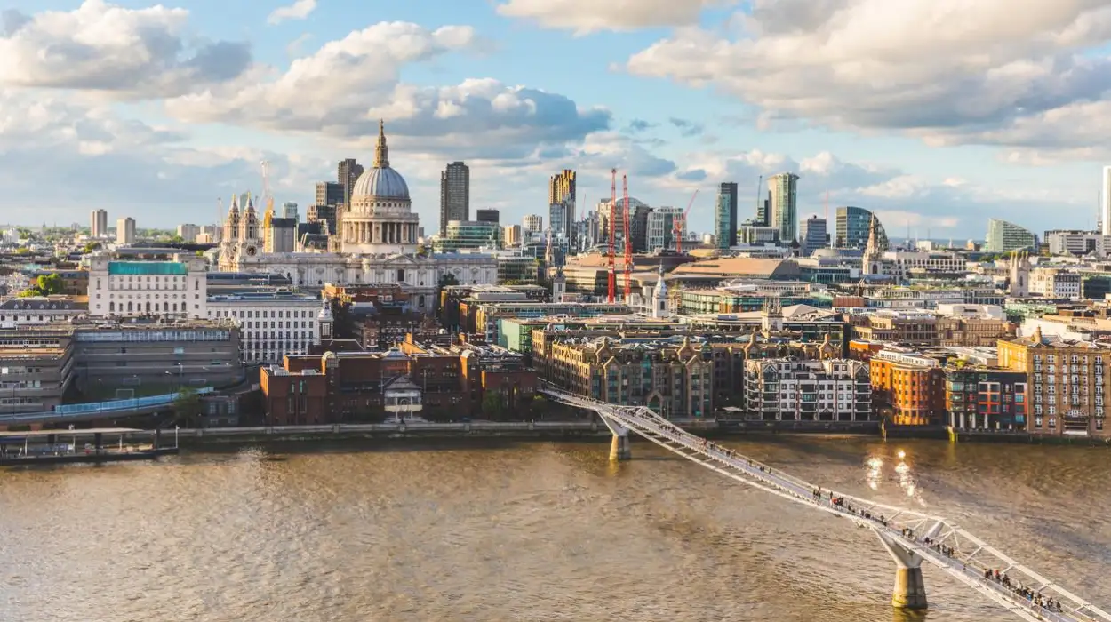
St Paul’s Cathedral became one of London’s defining skyline landmarks after Sir Christopher Wren rebuilt the cathedral between 1675 and 1710 following the Great Fire of 1666. Its dome, elevated position, and monumental scale established a lasting visual focus for the City of London.
St Paul’s Cathedral stands on Ludgate Hill in the City of London. The site has a long religious history, with successive Christian buildings occupying the location before the present cathedral.
The medieval cathedral was severely damaged during the Great Fire of London in September 1666. The scale of the destruction created an opportunity for a completely new structure. Sir Christopher Wren, the English architect and scientist responsible for numerous post-Fire buildings, prepared plans for the replacement cathedral.
The final design combined a large domed central space with the longitudinal arrangement preferred for Anglican worship. The building received a Royal Warrant in May 1675 and was constructed between 1675 and 1710.
The cathedral’s dome became particularly important to London’s visual identity. Its elevated position on Ludgate Hill allowed it to remain visible from numerous parts of the capital. The building also became part of a wider group of Wren churches and civic structures that dominated the City skyline before the rise of modern high-rise construction.
St Paul’s Cathedral is Grade I listed and has exceptional architectural and historical significance. The surrounding conservation area also contains archaeological evidence connected with Roman, medieval, and post-Fire London. The City of London identifies the area as having considerable archaeological potential, including structural remains and extensive burials.
The cathedral’s importance extends beyond architecture. It has been associated with major national events, religious ceremonies, memorial services, and public commemorations. Its position also explains why modern London planning protects views toward the dome.
Several designated strategic views specifically involve St Paul’s Cathedral. These include Westminster Pier to St Paul’s Cathedral and King Henry VIII’s Mound in Richmond Park to St Paul’s Cathedral. London’s planning framework also uses St Paul’s Heights to protect the cathedral’s visibility from surrounding locations.
The relationship between St Paul’s and the surrounding skyline therefore demonstrates how historic architecture continues to influence modern urban planning.
What historical story does The Monument reveal about London’s skyline?
The Monument records London’s transformation after the Great Fire of 1666. Designed by Christopher Wren and Robert Hooke and built from 1671 to 1677, the 61-metre structure commemorates destruction while representing the rebuilding of the City around its historic street network.
The Monument stands near the northern end of London Bridge in the City of London. Its location has a direct connection with the Great Fire, which began near Thomas Farriner’s bakery in Pudding Lane on 2 September 1666.
The fire lasted four days and destroyed a substantial part of the medieval City. Timber-framed buildings, narrow streets, warehouses, and other structures contributed to the rapid spread of the flames. The destruction created an urgent requirement for reconstruction.
Parliament passed legislation supporting the rebuilding of the City and providing for a commemorative monument. The Monument was subsequently constructed between 1671 and 1677. Its design is traditionally associated with Sir Christopher Wren and Dr Robert Hooke.
The structure is a colossal Doric column made from Portland stone. Its pedestal contains inscriptions and sculptural decoration, while a gilded flaming urn forms the summit. The design therefore combines classical architectural language with direct reference to the fire.
The Monument also has an important relationship with viewing history. It includes a gallery reached by a spiral staircase. Its elevated position provided visitors with a high-level view across the City. This makes it an early example of a purpose-built public viewing structure in London.
Its symbolic importance also comes from the rebuilding that followed the fire. The post-1666 City increasingly used brick and stone rather than timber for buildings. Streets were improved in selected areas, new churches were constructed, and new infrastructure was introduced.
The Monument’s archaeological setting remains significant. Conservation research identifies archaeological potential associated with Roman buildings, medieval structures, and the historic Pudding Lane area. The surviving fabric of the Monument itself also retains substantial original material from its seventeenth-century construction.
Today, the surrounding skyline contains office towers and contemporary buildings that are far taller than the Monument. Its historical significance has therefore changed from being a dominant element of the City skyline to functioning as a preserved reference point within a much taller urban environment.
That contrast demonstrates how London’s skyline has evolved without eliminating its earlier landmarks.
Why does Tower Bridge remain one of London’s most important historic views?
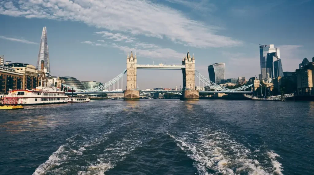
Tower Bridge remains one of London’s most important historic views because its 1894 construction solved a Victorian transport problem while preserving river access. Its Neo-Gothic towers, movable bascules, Thames setting, and relationship with the Tower of London created a distinctive landmark.
Tower Bridge was constructed because London needed another river crossing east of London Bridge. By the nineteenth century, rapid population growth and commercial expansion had increased pressure on the existing crossings.
The City of London Corporation established the Special Bridge or Subway Committee in 1876 after petitions called for a new crossing. More than 50 designs were submitted during the competition. The chosen design was developed by City architect Sir Horace Jones and civil engineer Sir John Wolfe Barry.
The Tower Bridge Act received Royal Assent on 14 August 1885. Construction began in 1886 and continued for eight years. Approximately 432 workers were involved in construction each day under the supervision of John Wolfe Barry.
The engineering problem was complex. The bridge needed to carry road and pedestrian traffic while allowing large vessels to reach the busy Pool of London docks. The solution was a bascule bridge, meaning its central sections could lift to allow ships to pass.
The external appearance was deliberately designed to complement the Tower of London. The steel structural frame was clad in stone and granite, producing the castle-like Neo-Gothic appearance that defines the bridge today. Historic England lists Tower Bridge at Grade I and records its opening in 1894.
The bridge opened officially on 30 June 1894. The Prince of Wales, later King Edward VII, conducted the opening ceremony. The first vessel to pass beneath the bridge was the harbour master’s cutter Daisy.
Tower Bridge also created a new visual relationship across the Thames. Views from the river, Tower Hill, London Bridge, Southwark, and the bridge itself connect several layers of London history. The Tower of London provides the medieval and royal context, while Tower Bridge represents Victorian engineering and transport.
The bridge’s high-level walkways are approximately 42 metres above the River Thames and extend 61 metres between the towers. The original construction also used approximately 31 million bricks, with the steel framework protected by Cornish granite and Portland Stone.
Tower Bridge remains a working bridge. Its historical machinery and movable bascules demonstrate that its original transportation function has not disappeared.
Its preservation therefore combines architectural conservation with continued infrastructure use.
How did Westminster Abbey and the Palace of Westminster shape London’s historic views?
Westminster Abbey and the Palace of Westminster shaped London’s historic views by concentrating religious, royal, and parliamentary institutions beside the Thames. Westminster Abbey has served as the coronation church since 1066, while the present Palace of Westminster emerged from nineteenth-century rebuilding.
Westminster developed as an important royal and religious centre during the medieval period. Westminster Abbey’s origins extend back more than a thousand years, while the present Gothic church largely reflects the rebuilding initiated by Henry III in 1245.
Westminster Abbey has served as Britain’s coronation church since 1066. William the Conqueror was crowned there on Christmas Day that year. The ceremony established a long institutional relationship between the monarchy and the Abbey. King Charles III became the 40th reigning monarch crowned at the Abbey in May 2023.
The Abbey is also an important burial and memorial site. More than 3,300 people are buried or commemorated there, including monarchs, statesmen, poets, scientists, musicians, and other significant figures.
The present Palace of Westminster has a different architectural history. The medieval parliamentary complex was almost completely destroyed by fire on 16 October 1834. Westminster Hall, the Undercroft Chapel, the Cloisters, and the Chapter House of St Stephen’s survived.
The fire resulted from the disposal of wooden tally sticks in furnaces beneath the House of Lords. The furnaces became excessively hot and ignited the surrounding structure. The resulting blaze destroyed most of the old Palace.
A competition was held in 1835 for the replacement building. The winning architect was Charles Barry, whose design used Gothic Revival architecture. Augustus Welby Pugin played a major role in the building’s Gothic interiors, including carvings, panelling, furniture, and decorative details.
Construction began in 1840. The rebuilding programme continued through the nineteenth century, with the Palace substantially completed by 1870. The Great Bell associated with Big Ben was first struck on 7 September 1859.
The Palace’s position beside the Thames created a powerful architectural composition. Westminster Bridge, Westminster Pier, the Palace, Westminster Abbey, and the surrounding streets form an interconnected historic landscape.
The relationship remains important to London’s planning system. The view from Westminster Pier toward St Paul’s Cathedral is one of the capital’s designated strategic views. This means the visual connection between Westminster and the City remains a consideration in planning decisions.
Westminster therefore demonstrates how political and religious institutions created a landscape whose historical importance extends far beyond individual buildings.
Why is Greenwich important to London’s history of science, navigation, and views?
Greenwich became important to London’s history of science and navigation after Charles II founded the Royal Observatory there in 1675. Its elevated position supported astronomical observation, while later work established Greenwich as a reference point for global timekeeping, longitude, and the Prime Meridian.
The Royal Observatory Greenwich was established during a period when maritime navigation was central to Britain’s economic and political interests. Determining latitude was comparatively straightforward, but determining longitude at sea remained a major scientific problem.
King Charles II founded the Royal Observatory by Royal Warrant in 1675. John Flamsteed became the first Astronomer Royal and was instructed to improve astronomical tables and support more accurate navigation.
The Observatory was constructed on high ground in Greenwich Park. Christopher Wren and Robert Hooke were involved in the design, and the foundation stone was laid by Flamsteed on 10 August 1675. Flamsteed moved into the completed building less than a year later.
The location was important because astronomical observations required a clear view of the sky. Greenwich’s elevated position also created an expansive visual relationship with the River Thames and central London.
The Observatory’s scientific importance continued to grow. Astronomers collected observations that contributed to navigation, cartography, astronomy, and timekeeping. Greenwich eventually became associated with Greenwich Mean Time and the Prime Meridian.
The historic Prime Meridian is defined as 0° longitude and passes through the Observatory site. Royal Museums Greenwich identifies the Observatory as the birthplace of Greenwich Mean Time and the historic Prime Meridian.
The site is also archaeologically significant. Historic England lists the Royal Observatory as a scheduled monument, citing the survival of historic buildings and below-ground remains. The site provides evidence for the development of astronomy and its contribution to maritime history, international cartography, and timekeeping.
Greenwich Park itself forms an important part of London’s protected visual landscape. The London Plan identifies Greenwich Park to Central London as a designated strategic panorama. The view demonstrates how a historic landscape can function as both recreational space and an important visual framework for the capital.
Greenwich therefore connects landscape, science, monarchy, navigation, and international standards within one historic setting.
To experience this historic landmark in person today, consult our comprehensive [Best Places to Watch Sunset in London With Unforgettable Skyline and River Views] for itineraries and visiting parameters.
How does Primrose Hill preserve a historic view of London today?
Primrose Hill preserves a historic view of London because its elevated landscape provides a protected panorama toward Central London. The hill became Crown property in 1841, formed part of the wider Regent’s Park landscape, and remains one of London’s designated strategic viewpoints.
Primrose Hill forms part of the Regent’s Park landscape in north London. The area was historically associated with Marylebone Park, a large tract of land containing woodland, open fields, and deer.
The land was appropriated by Henry VIII as part of a royal hunting landscape. By the fifteenth century, the woodland character had changed, and open meadows and fields occupied the hill. The name Primrose Hill became established during the Elizabethan period.
The hill was purchased from Eton College in 1841. Its acquisition extended public parkland associated with the development of Regent’s Park and provided open-air recreational space for London’s growing population.
The development of Regent’s Park was closely connected with the Regency period. Architect John Nash designed the park and its surrounding urban development during the early nineteenth century. The landscape became an important example of planned urban development combining residential architecture, roads, gardens, and public open space.
Primrose Hill occupies an elevation of almost 63 metres above sea level. Its summit provides an extensive panorama across London. The Royal Parks describes it as one of the best viewpoints in London, while its trees are deliberately kept low to protect the visual connection with the city.
The summit also contains cultural references. A York stone edging carries an inscription associated with poet and artist William Blake. A replacement for the historic Shakespeare’s Tree was planted in 1964 after the original tree had been planted in 1864 to mark the 300th anniversary of William Shakespeare’s birth.
The hill is now one of London’s designated strategic viewpoints. The London Plan specifically identifies Primrose Hill to Central London as a protected panorama. This status means development within the wider viewing area is assessed in relation to the protected skyline.
Primrose Hill demonstrates that London’s historic views do not depend exclusively on monumental architecture. The landscape itself can be historically significant because it provides a long-established public perspective over the capital.
How have London’s historic views been protected as the skyline changed?
London protects important historic views through planning policies that control development affecting designated panoramas, linear views, river prospects, and landmark settings. These measures preserve visual relationships involving St Paul’s Cathedral, Greenwich Park, Primrose Hill, Parliament Hill, Tower Bridge, and other historic locations.
London’s skyline has changed substantially since the seventeenth century. The post-Fire City was dominated by church towers, civic buildings, and the dome of St Paul’s Cathedral. Victorian London added railway stations, bridges, industrial structures, and monumental public buildings.
The twentieth century introduced larger office buildings and new construction technologies. The twenty-first century has added tall commercial and residential towers across several parts of the capital.
Historic landmarks therefore exist within an increasingly complex skyline. Protecting their settings requires more than preserving the buildings themselves.
The Greater London Authority’s planning framework identifies a series of strategic views. These include panoramas from Alexandra Palace, Parliament Hill, Kenwood, Primrose Hill, Greenwich Park, and Blackheath Point. It also includes linear views from The Mall to Buckingham Palace and Westminster Pier to St Paul’s Cathedral, together with river prospects involving historic bridges and landmarks.
The system recognises that views can contain several components. A historic landmark may form the focal point, while the foreground, middle ground, skyline, river, or surrounding landscape establishes its setting.
St Paul’s Cathedral receives additional protection through St Paul’s Heights. This planning mechanism controls building heights in areas where development could obstruct important views of the cathedral. The system reflects the cathedral’s longstanding role as a visual landmark in the City.
Heritage protection also operates through statutory listing. Tower Bridge is Grade I listed, while The Monument is also designated for its special architectural and historic interest. The Royal Observatory is a scheduled monument, reflecting the importance of both its buildings and archaeological remains.
Preservation therefore operates at several levels. Individual structures receive legal protection. Historic areas receive conservation controls. Strategic views receive planning protection. Archaeological sites receive separate consideration where buried evidence survives.
These measures do not freeze London’s skyline in a single historical period. They manage change so that new architecture does not erase significant historic relationships.
What do London’s historic landmarks reveal about the city’s long-term development?
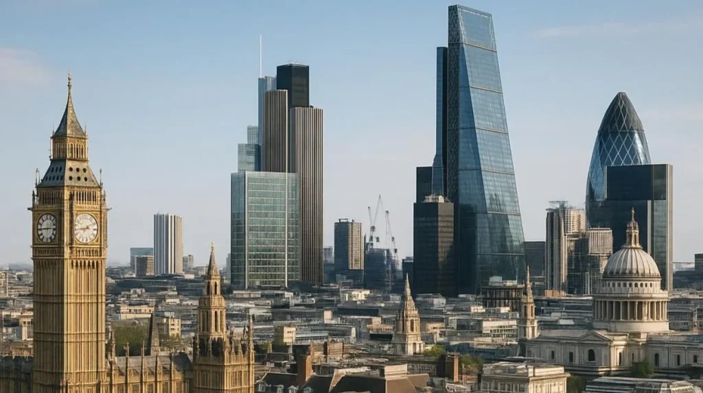
London’s historic landmarks reveal a continuous process of political, religious, scientific, commercial, engineering, and architectural change. Westminster represents monarchy and Parliament, St Paul’s represents post-Fire reconstruction, Greenwich represents science, Tower Bridge represents Victorian infrastructure, and Primrose Hill represents planned public landscape.
The history of London’s best views is therefore also a history of urban development.
Westminster Abbey represents medieval religious and royal authority. Its coronation tradition began in 1066 and continued through successive political systems and royal dynasties. The building visible today largely reflects medieval Gothic reconstruction initiated by Henry III in the thirteenth century.
The Palace of Westminster represents the institutional development of Parliament. Its present form emerged after the catastrophic fire of 1834, when Victorian architects created a purpose-built Gothic Revival complex that incorporated surviving medieval structures such as Westminster Hall.
St Paul’s Cathedral represents the reconstruction of the City after the Great Fire of 1666. Its construction between 1675 and 1710 transformed the City skyline and established a major architectural landmark that remains central to London’s protected views.
The Monument preserves the memory of the same disaster. Its construction between 1671 and 1677 shows how commemoration and urban reconstruction became linked after the fire. Its viewing gallery also demonstrates the long history of elevated public perspectives over the City.
The Royal Observatory represents another form of transformation. Its foundation in 1675 reflected the increasing importance of scientific research to maritime navigation. The later association with the Prime Meridian and Greenwich Mean Time gave the site international significance beyond London.
Tower Bridge represents the Victorian response to transport pressure. Its construction between 1886 and 1894 combined structural steel, hydraulic engineering, stone cladding, and Neo-Gothic architecture. It continues to perform its original function as a working river crossing.
Primrose Hill represents another aspect of urban history. Its preservation as open parkland demonstrates the nineteenth-century development of public recreational landscapes alongside expanding residential London. Its protected panorama continues to connect open space with the modern city skyline.
Together, these sites demonstrate that London’s visual identity was not created during one historical period. It accumulated through successive phases of rebuilding, political change, scientific development, industrialisation, public planning, and heritage conservation.
The best London views therefore function as historical evidence. A single panorama can contain medieval institutions, seventeenth-century reconstruction, Victorian engineering, scientific heritage, public parks, and contemporary architecture.
That layered character explains why London’s protected views remain important to historians, educators, researchers, visitors, and heritage professionals.
The landmarks continue to provide fixed reference points while the city around them changes. Their survival ensures that future generations can study not only individual buildings but also the relationships between architecture, landscape, infrastructure, government, science, and society.
London’s historic views are consequently part of the capital’s cultural heritage in their own right. They preserve the connection between the physical city and the historical events that shaped it.
Frequently Asked Question
What are the best historic landmarks for views in London?
St Paul’s Cathedral, Tower Bridge, the Palace of Westminster, Westminster Abbey, the Monument, and the Royal Observatory Greenwich are among London’s most important historic landmarks connected with notable city views.