London’s sunset viewpoints reveal the capital as a layered historic landscape. Medieval churches, royal parks, Victorian bridges, industrial landmarks, modern skyscrapers, and the River Thames form a single visual panorama. The best places to watch sunset in London are therefore also places where centuries of urban development remain visible.
- Why are London’s best sunset viewpoints also important historical places?
- Where can you watch sunset from Greenwich Park?
- Why is Parliament Hill one of the best places for a London skyline sunset?
- What makes Primrose Hill a historic London sunset viewpoint?
- Where can you watch the sunset beside the River Thames?
- Why is Tower Bridge an important sunset location?
- Can you watch sunset from The Shard?
- Which City viewpoint provides a high-level sunset over London?
- Why is Tate Modern one of the best free places for sunset views?
- How does London’s river shape its sunset skyline?
- How have London’s sunset viewpoints been preserved?
- What historical timeline explains London’s modern sunset skyline?
- Which London sunset viewpoint is best for understanding the city’s history?
- What is the long-term historical importance of London’s sunset viewpoints?
- Frequently Asked Question
From Greenwich Park and Parliament Hill to the South Bank, Primrose Hill, Tower Bridge, The Shard, and high-level City viewing galleries, each location presents a different relationship between London’s history and its modern skyline. Some viewpoints stand on ancient ground. Others occupy converted industrial sites or contemporary towers.
The River Thames remains central to this geography. It shaped London’s commerce, transport, defence, industry, and political development. The skyline visible above the river reflects that history. St Paul’s Cathedral represents post-Great Fire reconstruction. Tower Bridge represents Victorian engineering. The Shard represents twenty-first-century high-rise development. Greenwich connects the river to royal patronage, maritime science, astronomy, and global navigation.
Why are London’s best sunset viewpoints also important historical places?
London’s finest sunset viewpoints combine elevated geography with historic architecture, river corridors, royal landscapes, industrial heritage, and modern skyscrapers, allowing visitors to observe how London developed from a medieval river settlement into a global metropolitan centre.
Sunset viewing in London is closely connected to geography. The capital occupies a broad basin crossed by the Thames, with several elevated areas providing long sightlines toward the west, centre, and east.
The historical importance of these viewpoints comes from the way London expanded around natural and built features. Hills such as Parliament Hill and Primrose Hill provided elevated ground long before the modern skyline existed. Greenwich Park later became a royal landscape with scientific and navigational importance.
The Thames became the principal commercial artery of London. The river supported wharves, docks, warehouses, shipbuilding, passenger transport, and international trade. The skyline developed around these activities.
London’s rebuilding after the Great Fire of 1666 created another important visual layer. Sir Christopher Wren designed St Paul’s Cathedral and numerous churches during the reconstruction of the City. St Paul’s later became one of the defining landmarks visible from riverside viewpoints.
The Industrial Revolution introduced railway stations, factories, warehouses, power stations, and bridges. Some industrial structures disappeared, while others were adapted for cultural use. Bankside Power Station, for example, became Tate Modern, creating one of London’s most important examples of industrial adaptive reuse.
The twentieth and twenty-first centuries added high-rise architecture. The Gherkin, The Shard, 22 Bishopsgate, and other towers transformed the City skyline. These buildings now appear alongside structures hundreds of years older.
Sunset therefore provides a useful visual study of London’s historical continuity. The same horizon can contain medieval foundations, Tudor associations, Georgian planning, Victorian engineering, twentieth-century industrial buildings, and contemporary architecture.
Where can you watch sunset from Greenwich Park?
Greenwich Park provides one of London’s strongest historic sunset viewpoints, combining an elevated royal landscape with views across the Thames toward Canary Wharf, the City skyline, and modern Docklands architecture.
Greenwich Park occupies approximately 73 hectares and is the oldest enclosed Royal Park. Its elevated position creates a broad panorama toward the River Thames and the northern side of London. The park forms part of the Maritime Greenwich World Heritage Site.
The park’s history reaches back to Roman Britain. Archaeological investigation identified the remains of a Roman temple in the southern part of the park. More than 30 Anglo-Saxon burial mounds also survive within the landscape. These remains demonstrate that Greenwich’s historical significance predates its royal associations.
Royal ownership became central to Greenwich after Humphrey, Duke of Gloucester, inherited the land in 1427. Greenwich subsequently became associated with the Tudor monarchy. Henry VIII was born at Greenwich, while Mary I and Elizabeth I were also born there.
During the seventeenth century, Greenwich became a centre of architectural and scientific development. André Le Nôtre influenced the formal landscape design, while Sir Christopher Wren designed the Royal Observatory and contributed to the architectural character of the area.
The Royal Observatory was founded in 1675 under King Charles II. Its original purpose was to improve astronomical observations and maritime navigation. The institution later became fundamental to the development of Greenwich Mean Time and the international history of longitude.
The sunset view from Greenwich Park therefore connects several historical themes. The foreground contains royal and scientific heritage. The middle distance contains the Thames and the Old Royal Naval College. The horizon contains Canary Wharf and the modern Docklands skyline.
Maritime Greenwich was inscribed as a UNESCO World Heritage Site in 1997. Its significance derives from the combination of royal history, architecture, landscape design, maritime science, and education.
For visitors interested in the wider heritage of the district, the viewpoint also provides a logical starting point for understanding Greenwich as more than a photography location.
Why is Parliament Hill one of the best places for a London skyline sunset?
Parliament Hill is one of London’s highest natural viewpoints at 98 metres, providing a legally protected panorama that includes St Paul’s Cathedral, The Shard, the Gherkin, the Palace of Westminster, and other major landmarks.
Parliament Hill stands on Hampstead Heath in north London. Its elevation of 98 metres, or 321 feet, makes it one of the capital’s most significant natural viewpoints. The City of London identifies the site as a major location for panoramic views across the capital.
The name Parliament Hill is connected with the English Civil War of the seventeenth century. Parliamentarian forces used the elevated ground as a strategic lookout. The location therefore has direct associations with one of the most consequential political conflicts in English history.
Parliament Hill became part of Hampstead Heath in 1888. Its landscape subsequently gained importance as protected public open space. The panoramic view is legally protected, preventing development from destroying the relationship between the hill and the London skyline.
The view includes several different periods of London’s architectural history. St Paul’s Cathedral represents the post-1666 rebuilding of the City. The Palace of Westminster represents the nineteenth-century Gothic Revival. The Gherkin and other City towers represent contemporary commercial architecture.
The viewpoint is particularly useful for understanding London’s urban scale. From the hill, the city does not appear as a collection of isolated landmarks. Instead, historic buildings and modern towers form a continuous urban field.
Hampstead Heath itself also contains important historical infrastructure. The Highgate Ponds were originally constructed as reservoirs in the seventeenth century to supply drinking water to London. Their connection to the River Fleet demonstrates how natural landscapes were incorporated into the capital’s expanding water infrastructure.
For a historical sunset view, Parliament Hill is particularly valuable because the landscape itself is part of London’s heritage rather than simply a platform constructed to observe the city.
What makes Primrose Hill a historic London sunset viewpoint?
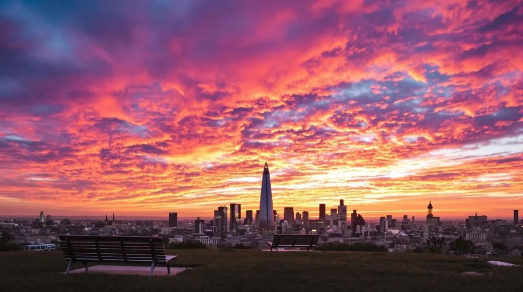
Primrose Hill rises almost 63 metres above sea level and forms one of London’s six protected viewpoints, offering an unobstructed skyline panorama shaped by royal parkland, nineteenth-century landscape management, and long-standing cultural associations.
Primrose Hill forms part of Regent’s Park and provides a clear view across central London. The summit is almost 63 metres above sea level, and the Royal Parks maintains low vegetation around the viewpoint to protect the panorama.
The site is historically connected to the wider development of Regent’s Park. During the nineteenth century, London’s expanding population increased pressure on open land. Royal parks became important public landscapes as the capital grew.
Primrose Hill also contains cultural commemorations. A tree known as Shakespeare’s Tree was planted in 1864 to mark the 300th anniversary of William Shakespeare’s birth. The original tree was replaced in 1964.
The summit carries an inscription associated with poet and artist William Blake. This adds a literary layer to the landscape and demonstrates how London’s open spaces became associated with cultural memory as well as recreation.
From the summit, the skyline extends across central London. The viewpoint is particularly useful for identifying the relationship between low-rise historic neighbourhoods and taller commercial districts.
The Royal Parks classifies the summit as one of London’s six protected viewpoints. This designation is significant because London’s skyline is not treated solely as a collection of buildings. Certain long-distance views have planning and heritage value.
Primrose Hill therefore provides a useful example of landscape preservation. The absence of tall structures around the summit is not accidental. It results from deliberate management intended to maintain a historic public panorama.
Where can you watch the sunset beside the River Thames?
The South Bank provides a continuous riverside setting where sunset views include the London Eye, Palace of Westminster, Westminster Bridge, St Paul’s Cathedral, Millennium Bridge, Tate Modern, and the evolving central London skyline.
The South Bank is one of London’s strongest locations for combining sunset, river scenery, and architectural history. The Thames provides the foreground while historic Westminster and the City form contrasting sections of the skyline.
The London Eye stands prominently beside the river. At 135 metres, it provides elevated 360-degree views and is one of the capital’s most recognisable modern landmarks.
Westminster Bridge connects the South Bank with the Palace of Westminster. The present bridge dates from the nineteenth century and forms part of a historic transport corridor across the Thames.
Further east, the Millennium Bridge provides a pedestrian connection between Tate Modern and St Paul’s Cathedral. The bridge opened in 2000 and created a direct visual axis between the modern art museum and Wren’s cathedral.
Tate Modern adds another important historical layer. The museum opened in 2000 inside the former Bankside Power Station. Herzog & de Meuron transformed the industrial structure into a major museum while retaining important elements of the power station’s architectural character.
The transformation of Bankside Power Station demonstrates the changing economic geography of London. The area once supported industrial energy production. It later became a cultural district dominated by museums, galleries, restaurants, offices, housing, and tourism.
The river itself provides the historical continuity. Commercial and industrial activity once depended on the Thames. The modern South Bank uses the same waterfront for public recreation and cultural institutions.
To experience this historic riverside district in person today, consult our comprehensive [Historic Landmarks Behind London’s Best Views and Their Remarkable Historical Stories Today] for itineraries and visiting parameters.
Why is Tower Bridge an important sunset location?
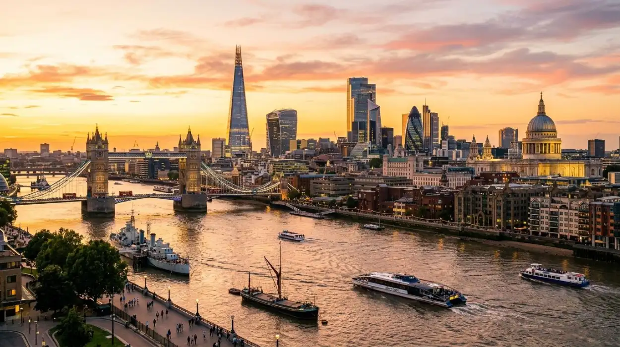
Tower Bridge combines Victorian engineering, the historic Pool of London, the Tower of London, and the modern eastern skyline, making its riverside setting one of the strongest locations for studying London’s commercial and architectural transformation.
Tower Bridge opened in 1894 and was built to provide a new river crossing in the eastern part of central London. Its movable bascules allowed river traffic to pass beneath the roadway.
The bridge stands beside the Pool of London, the historic stretch of the Thames associated with London’s port and maritime commerce. Its location therefore reflects the importance of the river to the city’s economic development.
The Tower of London stands nearby. Founded after the Norman Conquest, the fortress developed into a royal palace, prison, armoury, treasury, and ceremonial site. Its stone architecture provides a sharp historical contrast with Tower Bridge.
The eastern skyline introduces another period. Canary Wharf and Docklands developed on land once dominated by commercial docks. The decline of traditional dock activity during the twentieth century created opportunities for redevelopment.
Sunset from the Tower Bridge area therefore exposes London’s transition from a port-centred city to a service and financial economy.
The bridge itself is also an example of technological history. Its engineering combined steel construction, suspension principles, and hydraulic machinery. The original hydraulic system was later converted to electricity, while the bridge continues to operate as an active river crossing.
The visual relationship between Tower Bridge and the surrounding skyline makes the location especially useful for educators discussing infrastructure, industrialisation, maritime trade, and urban redevelopment.
Can you watch sunset from The Shard?
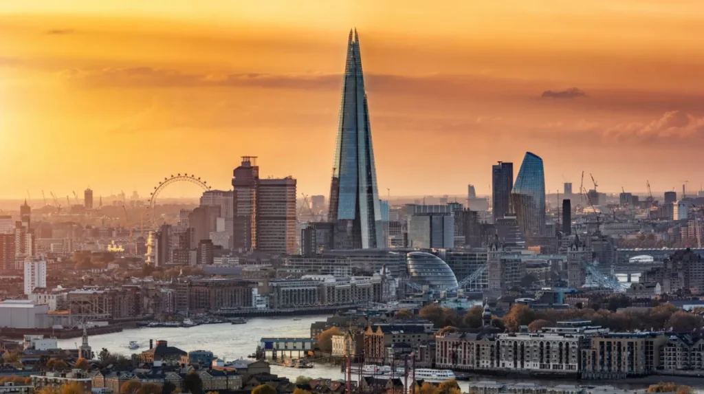
The Shard provides one of London’s highest public viewpoints at approximately 300 metres, with views extending across the Thames toward Tower Bridge, Canary Wharf, St Paul’s Cathedral, Westminster, and other major landmarks.
The Shard dominates the skyline around London Bridge. Its observation experience reaches approximately 300 metres above the city, making it one of the highest public viewpoints in London.
The building opened in 2012 and became a defining feature of London’s twenty-first-century skyline. Its location is historically significant because London Bridge has been a major crossing point for centuries.
The area around London Bridge has undergone repeated transformation. Medieval markets, inns, warehouses, railway infrastructure, and nineteenth-century commercial buildings shaped the district before contemporary redevelopment introduced new offices, apartments, restaurants, and public spaces.
From The Shard, the Thames becomes a geographical guide through London. Looking west reveals central landmarks including St Paul’s Cathedral and the Palace of Westminster. Looking east reveals Tower Bridge, the City, and Canary Wharf.
The elevated viewpoint also demonstrates the increasing verticality of London. Historic London developed primarily through horizontal expansion. Modern commercial development increasingly uses height to accommodate offices, housing, hotels, and observation facilities.
The Shard’s observation levels include indoor galleries and an open-air Skydeck. Its height allows visitors to see the relationship between London’s historic core and its wider metropolitan landscape.
For historical research, the viewpoint is valuable because it reveals infrastructure that is difficult to understand from ground level. Railway lines, bridges, river bends, dense commercial districts, and historic churches become part of a single geographical system.
Which City viewpoint provides a high-level sunset over London?
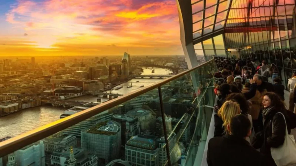
The City of London offers several elevated viewpoints where sunset illuminates historic churches, financial towers, the Thames, and major landmarks, creating a direct visual connection between medieval commerce and the modern financial district.
The City of London is the historic financial core of the capital. Its boundaries contain approximately one square mile, commonly called the Square Mile, and its urban landscape contains architecture from multiple periods.
The City skyline includes St Paul’s Cathedral, the Gherkin, the Walkie Talkie, 22 Bishopsgate, and numerous commercial towers. These buildings demonstrate the changing requirements of commerce, finance, communications, and office development.
The Lookout at 8 Bishopsgate provides a high-level viewing gallery on the building’s 50th floor. The City of London describes it as a panoramic viewpoint with views across the city, and evening visits provide views of landmarks as the setting sun changes the appearance of the skyline.
Another significant viewing location is Sky Garden at 20 Fenchurch Street. The building is known as the Walkie Talkie because of its distinctive curved form. The public garden occupies upper floors and provides extensive views across the City and Thames.
These viewpoints reveal an important planning issue. Modern towers are concentrated in specific clusters rather than distributed evenly across the capital. The City’s skyline therefore reflects planning controls, commercial demand, protected views, and historic building constraints.
St Paul’s Cathedral remains particularly important within this landscape. Its dome was designed by Christopher Wren after the Great Fire destroyed the medieval cathedral in 1666. The building opened a new chapter in London’s architectural history.
The juxtaposition of St Paul’s and modern towers demonstrates how the City has retained historic landmarks while accommodating substantial redevelopment.
Why is Tate Modern one of the best free places for sunset views?
Tate Modern provides a free public viewing terrace overlooking the Thames, St Paul’s Cathedral, Millennium Bridge, and the City, while its building preserves the industrial history of the former Bankside Power Station.
Tate Modern occupies Bankside Power Station, an industrial building that once generated electricity for London. The museum opened in 2000 after a major architectural conversion led by Herzog & de Meuron.
The power station’s transformation represents one of London’s most important examples of adaptive reuse. Instead of demolishing the industrial structure, architects retained its substantial form and integrated modern gallery spaces.
The viewing terrace provides a particularly strong sunset panorama because St Paul’s Cathedral stands directly across the Thames. The Millennium Bridge connects the two landmarks and creates one of London’s clearest modern pedestrian axes.
The view also demonstrates the changing character of Bankside. Industrial infrastructure once dominated the riverfront. Cultural institutions and public spaces later transformed the area into a major visitor destination.
Tate Modern’s historical importance therefore extends beyond its art collection. Its building records the shift from industrial energy production to cultural and tourism-led regeneration.
The location is especially relevant for students studying urban geography. The same riverfront can be analysed through several historical phases: medieval trade, industrialisation, twentieth-century deindustrialisation, and twenty-first-century cultural redevelopment.
How does London’s river shape its sunset skyline?
The Thames shapes London’s sunset skyline by connecting historic commercial districts, royal centres, bridges, docks, industrial sites, cultural institutions, and financial districts along one continuous geographical corridor.
The River Thames is the principal geographical feature linking many of London’s major landmarks. The river enabled settlement, transport, trade, defence, and industrial activity.
Medieval London developed around the river crossing and port. The City became an important commercial centre, while Westminster developed as a political and royal centre farther west.
The construction of bridges changed how London expanded. London Bridge connected the historic City with Southwark. Westminster Bridge connected the political centre with the growing South Bank. Tower Bridge later supported expansion around the eastern docks.
The river also influenced industrial geography. Warehouses, wharves, factories, power stations, and docks occupied the waterfront. Many of these sites later changed function.
Bankside is a clear example. The former power station became Tate Modern. Docklands provides another example, with former maritime infrastructure becoming a major financial and residential district.
This transformation is visible from elevated sunset viewpoints. The river acts as a continuous line through otherwise different districts.
The Thames also explains why certain London sunset locations are particularly effective. Water reflects changing light while providing an unobstructed horizontal foreground. Bridges and towers create fixed reference points for understanding the city’s structure.
The river is therefore not simply scenery. It is a major historical mechanism behind London’s development.
How have London’s sunset viewpoints been preserved?
London preserves important sunset viewpoints through protected landscapes, designated heritage areas, planning controls, public parks, protected panoramas, and conservation policies that balance modern development with historic views.
Greenwich Park is protected within the Maritime Greenwich World Heritage Site. The designation recognises the combined importance of its royal history, landscape design, architecture, maritime science, and astronomical heritage.
Parliament Hill has a legally protected panoramic view. This prevents development from undermining the long-distance relationship between the elevated landscape and central London.
Primrose Hill is another protected viewpoint. The Royal Parks maintains low vegetation at the summit to preserve the skyline panorama.
These examples demonstrate that a view can have heritage value even when the individual buildings within it are not protected as a single monument.
London’s skyline is also managed through planning policies concerning building height, protected views, conservation areas, and strategic landmarks.
The challenge has increased as the city has embraced high-rise development. New towers can alter established visual relationships. Planning therefore considers not only individual architectural quality but also how buildings appear within wider historic panoramas.
The preservation of views is important for future historical research. A protected panorama allows later generations to understand how the city developed while retaining evidence of earlier periods.
What historical timeline explains London’s modern sunset skyline?
London’s sunset skyline developed through successive phases including Roman settlement, medieval commerce, Tudor royal expansion, post-1666 rebuilding, Victorian industrialisation, twentieth-century deindustrialisation, and twenty-first-century high-rise development.
Roman London established an important settlement around the Thames. Archaeological evidence demonstrates the early importance of the river and surrounding transport routes.
Medieval London expanded through commerce, religious institutions, royal government, and river trade. London Bridge became a critical connection between the City and Southwark.
The Tudor period strengthened Greenwich’s royal significance. The Palace of Greenwich became an important royal residence, and several Tudor monarchs were born there.
The seventeenth century introduced major scientific and architectural developments. Greenwich Observatory was founded in 1675, while the Great Fire of 1666 led to the reconstruction of the City and the creation of Wren’s St Paul’s Cathedral.
The eighteenth and nineteenth centuries brought rapid population growth, industrialisation, railways, bridges, docks, and new forms of engineering. Tower Bridge, opened in 1894, represents this Victorian infrastructure phase.
The twentieth century brought industrial decline and major changes to the riverfront economy. Former industrial sites were increasingly converted or redeveloped.
The opening of Tate Modern in 2000 demonstrated the cultural reuse of industrial architecture. The Millennium Bridge also opened in 2000, strengthening pedestrian connections across the Thames.
The twenty-first century introduced a new generation of skyscrapers. The Shard, the Gherkin, 22 Bishopsgate, and other towers altered the skyline while protected historic landmarks remained visible.
London’s modern sunset panorama is therefore the accumulated result of more than two millennia of urban change.
Which London sunset viewpoint is best for understanding the city’s history?
Greenwich Park is strongest for royal and scientific history, Parliament Hill for protected panoramas, Primrose Hill for landscape and cultural history, the South Bank for river heritage, and Tower Bridge for maritime and industrial development.
No single viewpoint explains every part of London’s history. Each location reveals a different relationship between landscape, architecture, infrastructure, and urban growth.
Greenwich Park provides the strongest combination of royal history, astronomy, maritime heritage, archaeological evidence, and river views. Its inclusion within the UNESCO World Heritage Site reinforces its international significance.
Parliament Hill is particularly important for understanding protected views. Its elevation and strategic history demonstrate how natural geography influenced London’s political and military landscape.
Primrose Hill demonstrates the historical value of public landscape. Its protected viewpoint and literary associations show how open spaces became part of London’s cultural identity.
The South Bank provides the clearest connection between riverfront history and modern cultural regeneration. Tate Modern, the Millennium Bridge, the London Eye, and Westminster form a concentrated architectural sequence.
Tower Bridge provides the strongest connection to maritime commerce, Victorian engineering, and the historic Pool of London.
High-level City viewpoints such as The Lookout provide another perspective. They allow historic landmarks and modern financial towers to be studied within the same urban panorama.
What is the long-term historical importance of London’s sunset viewpoints?
London’s sunset viewpoints preserve more than attractive panoramas because they document the relationship between natural geography, historic buildings, transport infrastructure, economic change, architectural innovation, and conservation across centuries of urban development.
The long-term value of these viewpoints lies in their ability to connect individual buildings with broader historical processes.
A cathedral viewed from a modern tower represents more than architectural contrast. It demonstrates how London retained religious and civic landmarks while changing its commercial and technological infrastructure.
A Victorian bridge beside contemporary skyscrapers demonstrates the continuing importance of the Thames as a transport corridor.
A former power station converted into a museum demonstrates the transition from industrial production to cultural use.
A royal park overlooking Docklands demonstrates how historic landscapes can survive beside major commercial redevelopment.
These relationships are important for heritage preservation because historic significance increasingly depends on setting as well as individual structures.
London’s skyline will continue to change. New buildings, transport infrastructure, housing developments, environmental projects, and riverfront regeneration will alter the visual character of the capital.
Protected viewpoints provide continuity during this change. They allow future researchers to compare successive stages of London’s urban development.
For history enthusiasts, cultural tourists, educators, students, and heritage researchers, the best places to watch sunset in London therefore function as open-air historical observatories. Greenwich Park, Parliament Hill, Primrose Hill, the South Bank, Tower Bridge, Tate Modern, The Shard, and City viewing platforms each reveal a different chapter.
The sunset itself is temporary, but the urban evidence surrounding it is permanent. The Thames, bridges, parks, churches, royal landscapes, industrial buildings, and skyscrapers form a visual record of London’s transformation.
That combination of historical depth and modern architecture explains why London remains one of Europe’s most significant cities for studying the relationship between heritage, landscape, and urban change.
Frequently Asked Question
What are the best places to watch sunset in London?
The best sunset viewpoints include Greenwich Park, Parliament Hill, Primrose Hill, South Bank, Tower Bridge, Tate Modern, and The Shard. Each provides a different combination of skyline, river, historic architecture, and elevated views.