Richmond upon Thames developed from a medieval riverside settlement into one of London’s most historically important landscapes through its position on the River Thames, its long royal associations, the creation of Richmond Palace, the preservation of Richmond Green, and the development of protected parkland and historic architecture. Its transformation was shaped by successive monarchs, aristocratic residents, landscape designers, artists, local institutions, and conservation policies.
- How did Richmond’s location on the River Thames shape its history?
- What was Richmond called before it became Richmond?
- How did Henry VII transform Sheen into Richmond?
- Why was Richmond Palace so important in Tudor England?
- How did Richmond Green preserve the historic character of the town?
- How did royal hunting create the landscape of Richmond Park?
- What makes Richmond’s landscape historically distinctive?
- How did Georgian and Victorian development change Richmond?
- Why did artists and writers help establish Richmond’s visual identity?
- How did Richmond become accessible to the wider public?
- How has heritage preservation protected Richmond’s historic character?
- What historical evidence can visitors still see in Richmond today?
- Why is Richmond still one of London’s most important heritage landscapes?
- Frequently Asked Question
The modern identity of Richmond combines several historic environments within a concentrated area. The riverside preserves the geographical foundation of the settlement. Richmond Green retains the relationship between the former royal precinct and the historic town. Richmond Park demonstrates the scale of royal land management. Georgian and Victorian development records the town’s later transformation into a residential and cultural destination.
Historic England records a substantial concentration of heritage assets across Richmond upon Thames, including sites from prehistoric, medieval, post-medieval, and twentieth-century periods. The borough’s historic landscape therefore represents a long sequence of human occupation rather than a single architectural era.
How did Richmond’s location on the River Thames shape its history?
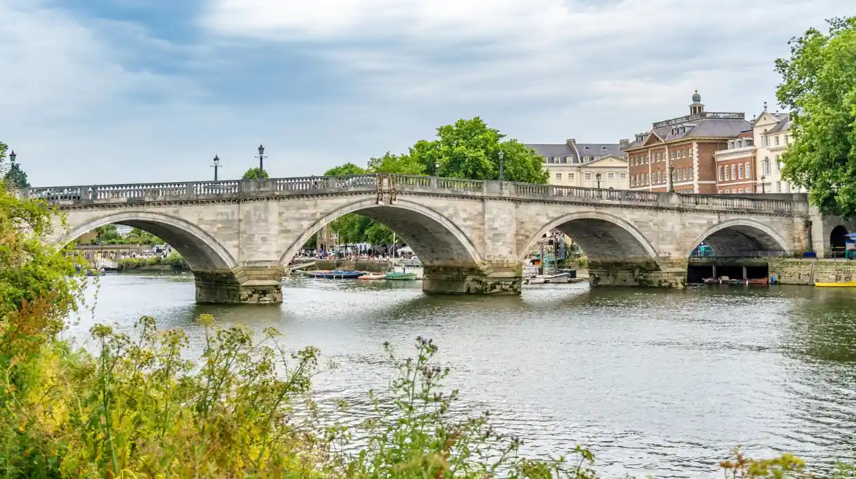
Richmond developed because the River Thames provided transport, fertile riverside land, strategic connections and an attractive setting for royal residences. Its position west of medieval London allowed the settlement to remain connected to the capital while retaining a distinct landscape of water, woodland and open land.
The River Thames was the fundamental geographical factor behind Richmond’s development. Before modern roads and railways dominated transport, the river connected settlements across southern England and provided an efficient route between Richmond and London.
Richmond occupies a prominent section of the Thames where the river landscape combines elevated ground, open views and access to the water. This physical setting made the area valuable for settlement and later for elite residences.
The riverside also shaped the town’s economy. Water transport moved people, building materials and commercial goods. The river supported local occupations and connected Richmond with neighbouring settlements including Kingston, Twickenham and central London.
Why was the Thames important to royal Richmond?
For medieval and Tudor monarchs, the Thames was a practical route between royal residences. Kings and queens travelled by water because river transport avoided many difficulties associated with poorly maintained roads.
The river also provided Richmond with an important environmental advantage. The settlement was close enough to London for royal administration and court life while remaining outside the dense urban environment of the medieval and early modern capital.
This combination became increasingly significant during periods of disease and political pressure. Royal households repeatedly moved between residences, and Richmond offered a riverside location connected directly to other important centres of power.
The continuing importance of the Thames explains why Richmond’s historic identity remains inseparable from its waterfront. The river was not simply a scenic feature added to an established town. It was the geographical system that helped create the town.
What was Richmond called before it became Richmond?
Before the name Richmond became established, the settlement was known as Sheen or Shene, a medieval manor with important royal connections. Royal occupation during the thirteenth and fourteenth centuries transformed Sheen into a significant location within England’s developing network of royal residences.
The history of Richmond begins long before the Tudor period. The Manor of Sheen was already associated with the English Crown during the Middle Ages.
The London Borough of Richmond upon Thames records royal connections extending across approximately 900 years. King Henry I stayed at the King’s House within the Manor of Sheen in 1125, while King Edward I later used Sheen as a royal residence.
These royal visits established a pattern that continued for centuries. A settlement with regular access to the monarchy acquired political and economic importance because royal households required accommodation, food, labour, administration and supporting services.
How did medieval royal ownership change Sheen?
Royal ownership concentrated resources in the area. The manor became connected with court administration and the wider political life of England.
Historical records show that Edward I held his court at Sheen and that royal household accounts documented expenditure associated with the residence. Such records demonstrate that Sheen was part of the operational geography of medieval monarchy rather than an isolated country retreat.
Edward II became direct owner of the Manor of Sheen in 1312. The area’s importance continued under Edward III, whose royal household invested in rebuilding the palace complex after the death of Queen Isabella.
The medieval landscape therefore created the institutional foundation for later Tudor Richmond. The palace, the manor, the riverside and the surrounding land were already connected to royal authority before the settlement received its modern name.
How did Henry VII transform Sheen into Richmond?
Henry VII transformed Sheen after the destruction of the earlier royal residence by rebuilding the palace and renaming the area Richmond. The new name reflected his title as Earl of Richmond and permanently connected the settlement with the Tudor dynasty.
A decisive change occurred during the reign of Henry VII, the first Tudor monarch. After becoming king in 1485, Henry established a new ruling dynasty following the Wars of the Roses.
The rebuilding and renaming of the royal residence strengthened the political symbolism of the new monarchy. The name Richmond referred to Henry’s former title, Earl of Richmond.
The association between the Tudor dynasty and Richmond was therefore deliberate. A royal residence became a physical expression of dynastic identity.
Why did the name Richmond have political importance?
Names communicated authority in medieval and early modern England. Royal buildings, towns and institutions often reflected the identity of monarchs and ruling families.
By connecting the rebuilt palace with the name Richmond, Henry VII associated the location with the Tudor monarchy and his own route to the throne.
The change also separated the new royal identity from the older name Sheen. Over time, Richmond became the dominant name for the settlement and the surrounding district.
The Royal Parks records that Henry VII changed the name associated with the area around 1501, reflecting his title as Earl of Richmond.
The naming process demonstrates an important mechanism of historical change. Political power altered the built environment, and the altered environment then influenced local identity for centuries.
Why was Richmond Palace so important in Tudor England?
Richmond Palace became one of the Tudor monarchy’s major residences and placed the settlement at the centre of royal government, ceremony and domestic life. Its presence stimulated local development while permanently linking Richmond with some of England’s most important historical figures.
Richmond Palace stood between Richmond Green and the River Thames. This location connected the royal residence with both the town and the waterway that provided access to London.
The palace served successive Tudor monarchs and became an important component of the royal landscape of southern England.
Its significance extended beyond architecture. A palace was an administrative centre, a residence, a workplace and a location for ceremony. Courtiers, servants, craftsmen, officials and visitors created a large supporting community around the royal household.
Historic England identifies the Richmond Palace archaeological area as the location of an early medieval manor house and successive medieval palaces. The site later contained an important Lancastrian and Tudor palace, and surviving Tudor structures remain incorporated into later buildings.
What remains of Richmond Palace today?
Most of the palace disappeared after the seventeenth century, but archaeological and architectural evidence preserves its historical importance.
Historic England identifies the former palace precinct as an Archaeological Priority Area. The designation recognises the site’s importance for understanding the development of Richmond and the wider history of England’s royal landscape.
The survival of fragments is significant because historical landscapes are not preserved only through complete buildings. Archaeological remains, street patterns, property boundaries and reused structures also provide evidence.
Richmond therefore demonstrates how a town can retain a strong historical identity even after its largest royal building has largely disappeared.
How did Richmond Green preserve the historic character of the town?
Richmond Green preserved an open historic space beside the former royal precinct and became a central element of the town’s urban structure. Its survival maintained the visual relationship between historic buildings, public space and the former palace landscape across successive centuries.
Richmond Green occupies a central position within the historic town. Its importance comes from continuity.
The Green provides a surviving spatial connection with the period when Richmond was dominated by royal activity. While buildings around it changed, the open space remained a defining feature of the settlement.
The area around Richmond Green demonstrates how urban history is preserved through layout as well as architecture. Streets and open spaces can retain relationships established centuries earlier.
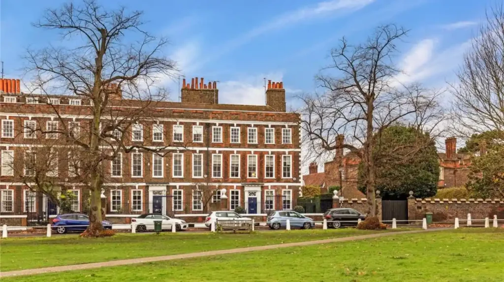
Why are historic open spaces important to Richmond’s heritage?
Historic open spaces preserve scale and context. A surviving building viewed without its original landscape often loses part of its historical meaning.
Richmond Green retains the relationship between the town, the former palace precinct and surrounding historic development.
This continuity helps explain why Richmond developed a distinctive appearance compared with many heavily rebuilt parts of London. Its historic character depends on the interaction between architecture and landscape.
The preservation of the Green also created a transition between the dense town and the wider riverside environment.
How did royal hunting create the landscape of Richmond Park?
Royal hunting transformed the land around Richmond into one of Britain’s most important historic park landscapes. Charles I enclosed Richmond Park in the seventeenth century, establishing a vast deer park whose boundaries, wildlife traditions and designed landscape continue to shape Richmond today.
The history of Richmond Park extends beyond the seventeenth century. The wider area had earlier royal associations and was known as the Manor of Sheen.
The decisive transformation occurred under Charles I. In 1625, Charles brought his court to Richmond during a period of plague in London and developed the surrounding landscape as a royal hunting environment.
The park was formally enclosed in 1637. Charles I created a substantial boundary wall to contain deer and define the royal landscape.
The Royal Parks describes the historic enclosure as an eight-mile wall and records the introduction of red and fallow deer. The historic relationship between the park and deer remains one of Richmond’s most recognisable surviving traditions.
How large is Richmond Park?
Richmond Park covers approximately 2,500 acres and is the largest of London’s Royal Parks. Its scale distinguishes it from smaller urban parks because it preserves extensive grassland, woodland and historic landscape features within Greater London.
The park is also a major ecological landscape. The Royal Parks identifies it as a National Nature Reserve, London’s largest Site of Special Scientific Interest and a European Special Area of Conservation.
This combination of royal history and environmental protection explains why Richmond’s beauty cannot be understood only through architecture. The town developed beside a landscape where political history and natural systems became permanently connected.
What makes Richmond’s landscape historically distinctive?
Richmond’s landscape is historically distinctive because prehistoric evidence, medieval settlement, royal parkland, designed views and riverside development survive within the same geographical area. These layers allow visitors and researchers to trace thousands of years of environmental and human change in one London district.
The Richmond landscape contains evidence from multiple periods. Historic England records heritage assets ranging from prehistoric sites to twentieth-century development.
Research within Richmond Park provides particularly important evidence of long-term occupation. The Richmond Park Management Plan records human occupation and landscape management from at least 6000 BC onwards, supported by prehistoric remains and surviving evidence of earlier land use.
Which historic landscape features still survive?
Several categories of evidence remain visible or documented within the landscape. Examples include prehistoric remains, ancient trees, historic field boundaries, trackways, hedgerows and ridge-and-furrow earthworks.
The survival of these features demonstrates that the royal park did not erase every earlier landscape. Instead, older evidence remained beneath and within later land management systems.
Veteran trees also function as historical evidence. Some trees predate modern urban development and preserve the ecological structure of earlier landscapes.
The Royal Parks records an oak tree estimated to be approximately 750 years old within Richmond Park.
How did Georgian and Victorian development change Richmond?
Georgian and Victorian development transformed Richmond from a primarily royal landscape into a fashionable residential and cultural destination. New houses, roads, public institutions and transport connections increased accessibility while historic parks, greens and riverside spaces remained central to the town’s identity.
The decline of Richmond Palace did not end Richmond’s importance. The town’s attractive location continued to draw wealthy residents and visitors.
During the Georgian period, elite residential development expanded around the historic settlement. Large houses and landscaped properties reflected the social status associated with living beside the Thames.
Richmond Park also acquired new structures. Pembroke Lodge, a Grade II listed Georgian mansion, was built in 1754. The Royal Parks records that the building was originally constructed as a four-room cottage for the park’s mole catcher before later becoming associated with prominent residents.
How did the Victorian period strengthen Richmond’s identity?
The Victorian period brought greater urban development and improved connections across London. Richmond increasingly functioned as both a residential town and a destination for visitors.
This process changed the social geography of the area. Royal exclusivity gave way to broader public access and urban growth.
Historic landscapes remained essential because development occurred around major surviving spaces rather than replacing them completely. Richmond Green, the Thames, Richmond Park and other historic environments continued to define the district.
The resulting pattern created the modern balance between town and landscape.
Why did artists and writers help establish Richmond’s visual identity?
Artists and writers strengthened Richmond’s reputation by recording its river, architecture, gardens and open landscapes. Their work helped establish the Thames Valley as a recognised cultural landscape and reinforced Richmond’s importance as a place where natural scenery and historical development remained visibly connected.
Richmond became increasingly important within Britain’s artistic and cultural geography because its landscape provided accessible views close to London.
The combination of river, hills, trees and historic buildings created subjects for painters, writers and visitors.
Cultural representation matters because public recognition often contributes to preservation. Landscapes that acquire artistic and historical significance become easier to identify as heritage assets.
Richmond’s visual identity therefore developed through both physical preservation and cultural interpretation.
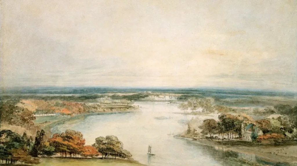
Why are protected views important in Richmond?
Views preserve relationships between places. A historic landscape can include the sightline between a hill, a river, a church or a major monument.
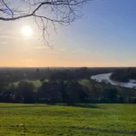
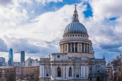
Richmond Park provides an important example through King Henry’s Mound. The Royal Parks identifies the location as a prehistoric burial chamber from the Bronze Age and records a protected view towards St Paul’s Cathedral approximately 12 miles away.
This demonstrates the complexity of Richmond’s landscape. One viewpoint connects prehistoric archaeology, royal history, eighteenth-century landscape planning and the modern London skyline.
How did Richmond become accessible to the wider public?
Richmond became a broader public destination as royal and elite landscapes gradually entered public use and improved transport connected the town more closely with London. Public access transformed historic spaces into shared heritage while retaining their architectural and environmental significance.
For centuries, many of Richmond’s most important landscapes were associated with restricted royal or private use.
The long-term development of London’s public park system changed this relationship. Former royal landscapes increasingly became accessible for recreation, education and heritage appreciation.
Richmond Park illustrates this transition clearly. The park originated as a royal hunting landscape but now functions as a major public open space managed for heritage and nature conservation.
The Royal Parks describes the wider history of London’s Royal Parks as a transition from royal land used for leisure and recreation towards parks used by the public.
What did public access change?
Public access changed the meaning of historic landscapes. A royal hunting ground became a shared civic environment.
The physical evidence of its original purpose remained visible through the deer population, boundary wall and landscape structure.
This combination created an important form of historical continuity. Modern visitors use the landscape differently from Charles I and his court, but the seventeenth-century park continues to shape the experience.
To experience this historic riverside landscape in person today, consult our comprehensive [Best Things to Do in Richmond for Scenic Walks, Parks, and Historic Landmarks] for itineraries and visiting parameters.
How has heritage preservation protected Richmond’s historic character?
Heritage preservation has protected Richmond through archaeological designation, listed buildings, conservation planning and landscape management. These systems recognise that Richmond’s significance depends on relationships between buildings, open spaces, archaeological remains, waterways and historic views rather than isolated monuments alone.
Modern preservation reflects the complexity of Richmond’s history.
Historic England’s records demonstrate the scale of heritage within Richmond upon Thames. The National Heritage List includes sites representing prehistoric, medieval, post-medieval and twentieth-century development.
The former Richmond Palace precinct receives specific archaeological recognition because buried and surviving evidence remains essential to understanding the Tudor royal landscape.
Why is archaeology important to Richmond’s future?
Archaeology provides evidence where buildings have disappeared. Richmond Palace is the clearest example.
Most of the palace no longer survives above ground, but archaeological investigation and surviving structures allow researchers to reconstruct aspects of its location and development.
The Royal Parks also began a major archaeology project in 2026 investigating historic underground waterways beneath Richmond Park and other Royal Parks. The project examines conduits, wells, reservoirs and tunnels associated with historic water systems and royal residences.
This work demonstrates that Richmond’s historical record continues to develop through new research.
What historical evidence can visitors still see in Richmond today?
Visitors can still encounter Richmond’s history through the River Thames, Richmond Green, surviving palace remains, historic streets, Richmond Park, ancient trees, deer, boundary walls, Georgian buildings and protected views. Together these features create a visible record of the area’s long transformation.
Richmond is unusual because many historical layers remain accessible within a relatively connected landscape.
The Thames preserves the original geographical framework.
Richmond Green preserves the urban relationship with the former royal precinct.
Richmond Palace survives through fragments and archaeology.
Richmond Park preserves the scale of seventeenth-century royal land management.
Pembroke Lodge represents eighteenth-century architectural development.
Ancient trees preserve ecological continuity across centuries.
Why does this combination matter?
Each feature provides context for the others.
The palace explains the importance of the Green.
The river explains the location of the palace.
The royal household explains the development of the wider park.
The park explains why Richmond retained extensive open land as London expanded.
The preservation of these connected environments gives Richmond its distinctive historical structure.
Why is Richmond still one of London’s most important heritage landscapes?
Richmond remains one of London’s most important heritage landscapes because its history survives across connected environments rather than within a single monument. Prehistoric evidence, royal residences, riverside geography, parkland, architecture and conservation systems collectively document more than two thousand years of landscape development.
Richmond’s modern reputation rests on a long historical process.
Its riverside location created the original conditions for settlement.
The medieval Manor of Sheen established royal connections.
The Tudor rebuilding of Richmond Palace gave the town a new dynastic identity.
Richmond Green preserved the spatial structure of the historic settlement.
Charles I’s enclosure of Richmond Park created one of London’s largest surviving historic landscapes.
Georgian and Victorian development expanded Richmond’s residential and cultural role.
Modern heritage and environmental protections preserved many of these earlier layers.
The result is a district where historical change remains visible.
Richmond did not become a riverside destination through one event, one building or one monarch. Its character emerged through the interaction of geography, monarchy, architecture, landscape design, transport, public access and preservation.
The River Thames remains the central geographical feature. The former palace remains central to Richmond’s political history. Richmond Park remains central to its landscape identity.
Together, these surviving elements explain how Richmond developed from medieval Sheen into one of London’s most recognisable historic riverside destinations and why its heritage continues to provide evidence for historians, educators, students, preservationists and genealogical researchers.
For future research, Richmond also remains an active historical landscape. Archaeological projects continue to investigate hidden infrastructure, heritage institutions continue to catalogue historic assets, and conservation systems continue to protect the relationship between the town, the river and its surrounding green spaces.
Richmond’s lasting importance lies in this continuity. The same district contains evidence of prehistoric occupation, medieval royal administration, Tudor monarchy, Stuart hunting landscapes, Georgian architecture and modern heritage conservation. Examples include prehistoric remains in Richmond Park, the archaeological precinct of Richmond Palace, the seventeenth-century deer park and eighteenth-century Pembroke Lodge.
This concentration of historical evidence ensures that Richmond remains not only a major London destination but also an important record of how the capital’s landscapes developed over time.
Frequently Asked Question
Which monarchs were connected with Richmond?
Several English monarchs were connected with Richmond and the former Manor of Sheen. Important examples include Edward I, Edward III, Henry VII, Henry VIII, Elizabeth I and Charles I.