London’s public spaces have served as the city’s shared living rooms for nearly two thousand years. Markets, squares, commons, churchyards, riversides, royal parks, and civic gathering places have supported trade, governance, recreation, protest, celebration, and cultural exchange across successive historical periods. These freely accessible locations connected residents from different social backgrounds, influenced urban development, and helped define London’s identity as Britain’s political, commercial, and cultural capital.
- Why have free public spaces always been central to London’s history?
- How did London’s royal parks become public spaces?
- Medieval origins of royal hunting grounds
- Public access during the seventeenth century
- Victorian park reforms
- What role did London’s market squares play in everyday community life?
- How did public squares influence political and social change in London?
- Why has the River Thames remained London’s greatest public space?
- How did London’s commons preserve community rights?
- How did churchyards and civic spaces strengthen local communities?
- What historical events transformed London’s approach to public space?
- Why do London’s historic public spaces remain important today?
- Frequently Asked Question
From the Roman settlement of Londinium to the modern Greater London Authority, public spaces have reflected changing ideas about citizenship, urban planning, public health, and democratic participation. Some originated as medieval market grounds, while others developed from royal hunting estates, parish commons, or nineteenth-century civic improvement schemes. Today, many remain protected through heritage legislation and conservation policies, preserving tangible links between London’s past and present.
Understanding these spaces explains how London’s communities evolved, how civic traditions developed, and why freely accessible places continue to hold national historical significance.
Why have free public spaces always been central to London’s history?
Free public spaces formed London’s civic foundation by enabling commerce, governance, religious gatherings, recreation, political demonstrations, and everyday social interaction. Across Roman, medieval, Tudor, Georgian, Victorian, and modern periods, these shared environments strengthened community identity while shaping London’s physical and cultural development over nearly two millennia.
Public space refers to land that remains accessible to everyone without an entrance fee. In London, this includes public squares, commons, parks, riverside walks, market streets, church precincts, and ceremonial routes. These environments allowed people from different occupations, social classes, and neighbourhoods to meet under shared civic customs.
Roman Londinium, established around AD 47, incorporated forums, marketplaces, baths, and public roads that encouraged administration and commercial exchange. Archaeological excavations demonstrate that the Roman Forum occupied approximately twelve acres, making it one of the largest civic complexes north of the Alps.
During the medieval period between the eleventh and fifteenth centuries, London’s population expanded rapidly. Public marketplaces developed around churches and guild halls, while open fields surrounding the City supported grazing rights under customary law. Commons became essential for food production and local economies.
The Tudor and Stuart eras introduced formal public ceremonies, royal processions, and civic celebrations that used London’s streets and squares as symbolic stages. Public access remained uneven because some spaces belonged to the Crown or ecclesiastical authorities, yet increasing urbanisation gradually expanded opportunities for communal use.
Industrialisation transformed London’s relationship with open space during the nineteenth century. Population growth exceeded six million residents by 1900. Urban reformers promoted parks and gardens as essential public health infrastructure, leading Parliament and municipal authorities to protect numerous green areas from private development.
Today, London’s public spaces support millions of residents and visitors annually while preserving centuries of architectural and historical continuity.
How did London’s royal parks become public spaces?
Royal parks evolved from exclusive hunting grounds into accessible public landscapes through centuries of royal policy, parliamentary reform, and municipal management. Their transformation expanded recreation, environmental protection, ceremonial traditions, and public wellbeing across central and outer London while preserving historic landscapes.
Medieval origins of royal hunting grounds
Several of London’s largest parks originated as medieval hunting estates reserved for English monarchs. Deer parks demonstrated royal authority while supplying game for the royal household.
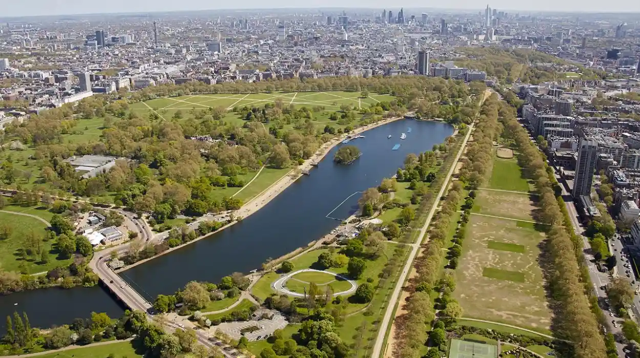
Hyde Park entered royal ownership in 1536 when King Henry VIII acquired land from Westminster Abbey during the Dissolution of the Monasteries. St James’s Park also became Crown property during the Tudor period.
Initially, ordinary Londoners possessed limited access. These enclosed landscapes primarily supported hunting, military exercises, and royal entertainment.
Public access during the seventeenth century
King James I introduced broader public access to Hyde Park during the early seventeenth century. By the Restoration under King Charles II, landscaped avenues encouraged walking, carriage driving, and social gatherings among London’s expanding population.
The development of The Mall within St James’s Park created one of Europe’s earliest ceremonial urban avenues. Its design reflected French landscape planning while strengthening connections between Westminster Palace and royal residences.
Victorian park reforms
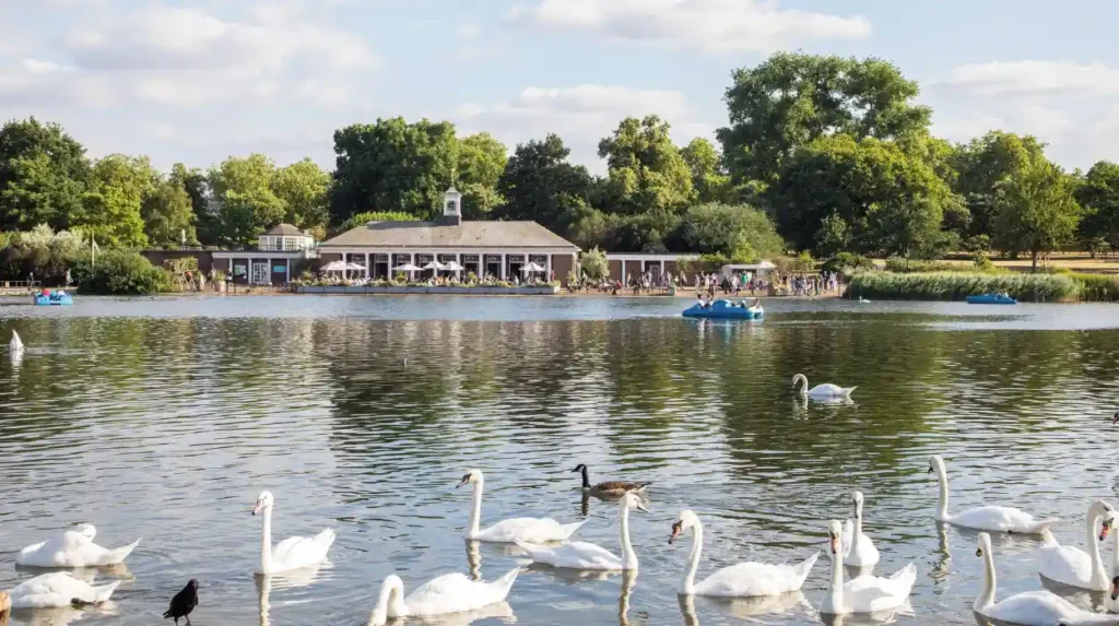
Victorian authorities improved paths, lakes, tree planting, lighting, sanitation, and public facilities. Landscape designers emphasised health, exercise, and fresh air rather than aristocratic exclusivity.
The Royal Parks now collectively protect approximately 5,000 acres of historic green space, including Hyde Park, Kensington Gardens, Green Park, Richmond Park, Bushy Park, Regent’s Park, Greenwich Park, St James’s Park, Brompton Cemetery, and others under unified management.
To experience these historic landscapes in person today, consult our comprehensive Best Free Experiences Every London Visitor Should Enjoy Without Spending Any Money for itineraries and visiting parameters.
What role did London’s market squares play in everyday community life?
Market squares connected economic activity with civic life by concentrating trade, communication, employment, taxation, justice, and social interaction within accessible urban centres. Their daily operation supported London’s expansion from a medieval trading settlement into a global commercial metropolis.
Markets represented far more than locations for buying food. They functioned as communication networks where news spread, labour was recruited, legal notices appeared, and political debates emerged.
Medieval charters regulated market rights. Local authorities controlled weights, measures, licensing, sanitation, and taxation to ensure fair trading standards. Guild organisations supervised craftsmanship and commercial quality.
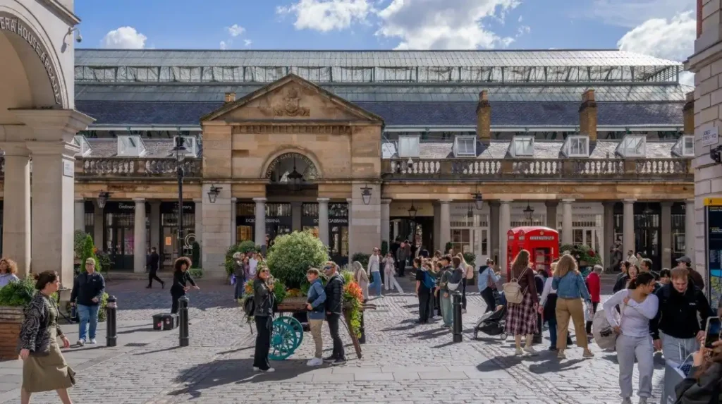
Historic locations including Cheapside, Smithfield, Leadenhall Market, Billingsgate, and Covent Garden illustrate how specialised markets developed around distinct industries.
Smithfield became England’s largest livestock market after the twelfth century, attracting merchants from across Britain. Billingsgate specialised in fish distribution through connections with the River Thames. Covent Garden developed into London’s principal fruit and vegetable wholesale market during the seventeenth century.
Public accessibility ensured that markets welcomed residents regardless of occupation or social background. Daily interaction strengthened neighbourhood identity while supporting economic resilience.
Many original market buildings survive through heritage protection programmes, demonstrating changing architectural styles from medieval timber structures to Victorian iron-and-glass construction.
How did public squares influence political and social change in London?
Public squares provided accessible settings for political debate, protest, celebration, military ceremony, and civic identity. Their openness enabled citizens to participate collectively in historic events that influenced constitutional reform, democratic traditions, labour movements, and national remembrance across successive centuries.
Urban squares became visible stages where government authority and public opinion intersected.
Westminster’s surroundings evolved into Britain’s political centre because Parliament, Westminster Abbey, and government institutions occupied neighbouring sites. Processions, elections, royal ceremonies, and demonstrations naturally concentrated within these accessible spaces.
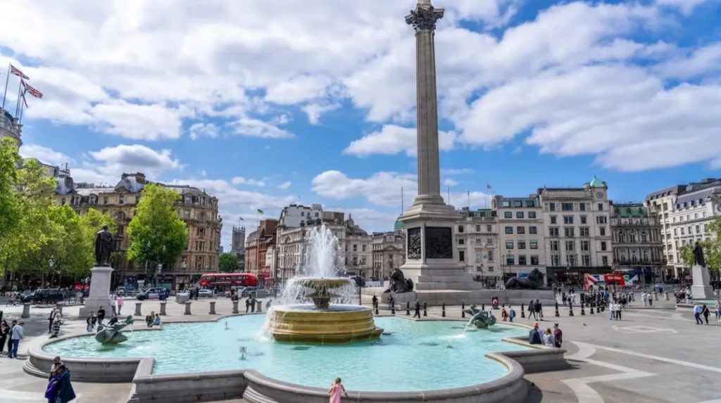
Trafalgar Square, completed during the 1840s, commemorated Admiral Horatio Nelson’s victory at the Battle of Trafalgar in 1805. Architect Charles Barry designed the square to create a monumental civic landscape connecting Whitehall with the West End.
Throughout the nineteenth and twentieth centuries, Trafalgar Square hosted demonstrations supporting electoral reform, labour rights, anti-war campaigns, and international solidarity movements. Public assembly reinforced London’s role within Britain’s democratic culture.
Parliament Square later became associated with constitutional debate because of its proximity to the Palace of Westminster. Statues honour influential figures including Winston Churchill, Mahatma Gandhi, Nelson Mandela, and Millicent Fawcett, representing diverse contributions to democratic history.
These public environments continue supporting peaceful assembly under modern legal frameworks regulating public demonstrations while preserving historic civic traditions.
Why has the River Thames remained London’s greatest public space?
The River Thames connected settlements, enabled trade, supported industry, shaped transportation, encouraged recreation, and influenced urban planning for nearly two thousand years. Continuous public interaction with the river established London’s economic strength and cultural identity throughout successive historical eras.
The Thames existed before London itself. Roman engineers selected the site of Londinium because the river offered navigable access between inland Britain and continental Europe.
Medieval wharves lined the waterfront, handling imported timber, grain, wine, cloth, spices, and manufactured goods. London’s prosperity depended upon river commerce.
Public stairs allowed residents to access water transport before extensive bridge construction. Watermen transported passengers between districts, making the river London’s principal transport corridor for centuries.
The Industrial Revolution intensified riverside activity through dock construction. The Port of London became one of the world’s busiest maritime centres during the nineteenth century, processing millions of tons of cargo annually.
Twentieth-century regeneration shifted emphasis from industry toward recreation, heritage, conservation, and tourism. Riverside promenades, restored warehouses, cultural institutions, and pedestrian routes reconnected communities with the Thames after decades of industrial decline.
Environmental restoration programmes have significantly improved water quality since the 1960s. Scientific monitoring now records over 125 fish species within the tidal Thames, demonstrating substantial ecological recovery.
How did London’s commons preserve community rights?
Commons protected longstanding communal rights including grazing, gathering fuel, recreation, and local agriculture. Their legal preservation prevented urban development from eliminating historic landscapes while maintaining neighbourhood identity, environmental diversity, and shared access across expanding metropolitan districts.
Common land developed through medieval customary law rather than individual ownership.
Residents possessed legally recognised common rights that included grazing livestock, collecting firewood, harvesting vegetation, and crossing open land. Lords retained ownership while communities exercised traditional usage rights.
As London’s suburbs expanded during the eighteenth and nineteenth centuries, developers increasingly threatened commons with enclosure and housing construction.
Campaigners successfully defended numerous landscapes through legislation and public activism.
Examples include Hampstead Heath, Wimbledon Common, Blackheath, Clapham Common, Tooting Commons, and Epping Forest.
The Metropolitan Commons Acts between 1866 and 1878 strengthened legal protection by restricting enclosure and promoting public recreation.
Epping Forest became permanently protected under the Epping Forest Act 1878 after sustained campaigning by the City of London Corporation.
Today these historic commons preserve biodiversity, archaeological remains, ancient woodland, and uninterrupted public access while demonstrating medieval land-management traditions.
How did churchyards and civic spaces strengthen local communities?
Churchyards and parish spaces combined religious functions with education, welfare, administration, remembrance, and neighbourhood interaction. These shared environments supported everyday community life before specialised civic institutions developed throughout London’s expanding urban districts during medieval and early modern history.
Parish churches served as local administrative centres as well as places of worship.
Churchyards hosted public announcements, charitable distributions, educational instruction, parish meetings, and seasonal festivals. Many communities relied upon parish authorities for poor relief before national welfare systems emerged.
Burial grounds also preserved genealogical evidence through memorial inscriptions, parish registers, and family monuments. Historians and genealogical researchers continue using these records to reconstruct London’s demographic history.
During disease outbreaks including the Black Death beginning in 1348 and later plague epidemics, churchyards reflected changing public health responses. Expanding burial grounds demonstrated London’s rapidly growing population.
Victorian cemetery reforms gradually transferred burials from overcrowded urban churchyards to larger suburban cemeteries, improving sanitation while preserving historic church landscapes as community gardens and memorial spaces.
Many restored churchyards now function as peaceful public gardens within densely developed neighbourhoods.
What historical events transformed London’s approach to public space?
Major disasters, population growth, industrialisation, urban reform, conservation legislation, and environmental planning repeatedly reshaped London’s public spaces. Each transformation reflected changing priorities involving health, accessibility, heritage preservation, transportation, and democratic participation throughout the city’s long development.
Several major historical events permanently altered London’s urban landscape.
The Great Fire of London in 1666 destroyed approximately 13,200 houses, 87 parish churches, and numerous civic buildings across the medieval City. Reconstruction introduced wider streets, improved fire regulations, and redesigned public spaces.
Industrialisation during the nineteenth century generated unprecedented urban density. Reformers recognised connections between overcrowding, disease, and inadequate green space.
Public Health Acts encouraged sanitation improvements, drainage systems, tree planting, and park creation.
The Second World War caused extensive bomb damage across London between 1940 and 1945. Post-war reconstruction created new civic squares, pedestrian routes, memorial landscapes, and housing estates incorporating public open space.
Late twentieth-century conservation policies shifted emphasis toward protecting historic character. Conservation Areas, Scheduled Monuments, and Listed Building legislation now safeguard thousands of historic sites across Greater London.
Urban planners increasingly integrate heritage conservation with sustainable development, biodiversity enhancement, climate resilience, and public accessibility.
Why do London’s historic public spaces remain important today?
Historic public spaces preserve archaeological evidence, architectural heritage, ecological diversity, democratic traditions, and community identity. Their continued accessibility enables education, cultural tourism, recreation, historical research, and social inclusion while connecting contemporary London with nearly two thousand years of urban history.
Historic landscapes provide direct physical evidence of London’s evolution.
Archaeological investigations continue revealing Roman roads, medieval foundations, Tudor gardens, and Victorian infrastructure beneath existing public spaces. These discoveries expand scholarly understanding of urban development while informing conservation practice.
Educational institutions use parks, squares, riversides, and historic commons as outdoor classrooms supporting history, geography, ecology, archaeology, and architecture.
Heritage tourism also contributes substantially to London’s economy. Millions of domestic and international visitors explore public spaces annually because they provide free access to nationally significant landmarks and cultural landscapes.
Modern conservation balances public use with environmental protection. Restoration projects improve accessibility, biodiversity, habitat management, flood resilience, and historical interpretation without compromising heritage value.
Digital mapping, archaeological surveys, geographic information systems, and archival digitisation further strengthen public understanding of London’s historic landscapes by making historical evidence more widely accessible.
The continuing preservation of these freely accessible places ensures that London’s civic history remains visible within everyday urban life rather than confined to museums alone.
Free public spaces have shaped London’s history through continuous public use across almost two millennia. Roman forums, medieval commons, Tudor ceremonial routes, Georgian squares, Victorian parks, and modern riverside promenades each reflect changing relationships between government, community, commerce, and the environment.
Their historical importance extends beyond architecture or landscape design. These places enabled democratic participation, supported economic growth, encouraged cultural exchange, preserved communal traditions, and strengthened neighbourhood identity across generations.
Today, London’s protected public spaces remain living historical resources. They preserve archaeological evidence, sustain biodiversity, support education, encourage recreation, and maintain public access to some of Britain’s most significant heritage landscapes. Their continued conservation ensures that future generations will experience the same shared environments that helped shape London’s remarkable historical development.
Frequently Asked Question
What are the most historically significant free public spaces in London?
Some of London’s most historically significant free public spaces include Hyde Park, St James’s Park, Trafalgar Square, Parliament Square, Hampstead Heath, the River Thames riverside, Covent Garden Piazza, Smithfield Market, Leadenhall Market, and Blackheath. These locations have played vital roles in royal ceremonies, public recreation, trade, political demonstrations, and everyday community life for centuries, making them enduring symbols of London’s cultural and historical heritage.