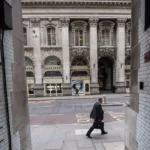
London is globally recognised for landmarks such as Buckingham Palace, the Tower of London, and Westminster Abbey. Yet the city’s historical character also survives in a network of narrow lanes, courts, passages, and forgotten streets that escaped wholesale redevelopment. These hidden alleys preserve medieval street layouts, Tudor property boundaries, Georgian commercial districts, and Victorian urban improvements. They provide direct evidence of how London’s physical landscape evolved across nearly 2,000 years.
- Why have London’s hidden alleys survived for centuries?
- What historical roles did London’s hidden alleys serve?
- Which historic hidden alleys best represent London’s past?
- How did medieval London shape today’s hidden street network?
- How did disasters reshape London’s hidden alleys instead of erasing them?
- What architectural features distinguish London’s hidden alleys?
- How do hidden alleys reveal London’s social and economic history?
- How are London’s hidden alleys protected today?
- Why do London’s hidden alleys remain historically important today?
Unlike London’s grand boulevards, hidden alleys reveal the everyday life of merchants, craftsmen, lawyers, printers, dock workers, religious communities, and residents. Many retain original names that reflect occupations, local landmarks, former markets, or long-vanished institutions. Their continued survival results from legal protections, historic property ownership, rebuilding after disasters, and conservation policies introduced during the twentieth century.
Today, these narrow streets represent valuable historical resources for researchers, educators, architects, genealogists, and visitors seeking authentic connections with London’s past.
Why have London’s hidden alleys survived for centuries?
London’s hidden alleys survived because medieval property boundaries remained legally protected, rebuilding after disasters followed existing street patterns, many districts escaped large-scale redevelopment, and modern conservation laws preserved historically significant urban landscapes that continued functioning as working streets rather than becoming obsolete.
The survival of London’s hidden alleys reflects continuity rather than chance. Although London experienced devastating events including the Roman withdrawal around AD 410, repeated medieval fires, the Black Death during 1348–1350, the Great Fire of 1666, wartime bombing between 1940 and 1941, and extensive twentieth-century redevelopment, numerous small streets remained intact.
The earliest surviving street network originated in Roman Londinium. Roman surveyors established roads linking administrative buildings, commercial centres, and the River Thames. Although many Roman structures disappeared, sections of their street alignments influenced later medieval development.
During the Middle Ages, London expanded organically instead of following a uniform city plan. Property owners constructed buildings on narrow plots facing busy commercial streets. Passageways developed between these plots, allowing access to workshops, warehouses, gardens, churches, and residences.
The Great Fire destroyed approximately 13,200 houses across nearly 436 acres of the City of London. Despite proposals from planners including Christopher Wren and John Evelyn for wide European-style boulevards, rebuilding largely respected existing ownership boundaries because compensating thousands of property owners proved impractical.
As a result, numerous medieval alleys continued into the rebuilt Georgian city.
Victorian engineers modernised London’s sanitation, transport, and utilities but concentrated major reconstruction on principal roads. Small service lanes remained economically useful for deliveries, workshops, warehouses, and legal chambers.
Following extensive wartime bomb damage, post-war planners prioritised preserving historically important districts. Conservation Areas introduced under the Civic Amenities Act 1967 protected many surviving historic streets from demolition.
What historical roles did London’s hidden alleys serve?
London’s hidden alleys functioned as commercial routes, residential communities, religious spaces, legal precincts, printing centres, and artisan workplaces that connected the city’s economic, political, and social institutions while supporting everyday urban life across multiple historical periods.
Medieval London relied heavily on compact urban development enclosed within defensive walls. Streets rarely exceeded several metres in width, while secondary alleys accommodated diverse urban activities.
Merchants stored imported goods arriving through Thames wharves in nearby warehouses connected by narrow passages. These goods included wool, spices, timber, wine, silk, and metals.
Craft guilds established workshops along quieter lanes where blacksmiths, goldsmiths, tailors, printers, and leatherworkers could operate without disrupting major commercial streets.
Religious institutions also shaped alley development. Monasteries, parish churches, hospitals, and charitable foundations maintained enclosed courtyards linked by narrow entrances. Following the Dissolution of the Monasteries between 1536 and 1541, many former religious properties became residential courts or commercial premises while retaining medieval access routes.
Legal districts surrounding the Inns of Court developed distinctive passageways connecting chambers, libraries, gardens, and courtrooms. These routes remain integral components of London’s legal landscape today.
Several alleys became recognised printing districts after William Caxton introduced printing to England in 1476. Publishers, booksellers, engravers, and stationers clustered around narrow streets near Fleet Street and St Paul’s Cathedral.
Residential courts housed workers employed in surrounding industries. Although living conditions often deteriorated during rapid nineteenth-century urbanisation, these communities formed important social networks documented in parish records, census returns, and municipal archives.
To experience this historic landscape in person today, consult our comprehensive [Why London’s Hidden Alleys Survived Centuries] for itineraries and visiting parameters.
Which historic hidden alleys best represent London’s past?
Several surviving alleys preserve distinct periods of London’s history through original layouts, historic buildings, commercial functions, and architectural details that illustrate medieval, Tudor, Georgian, Victorian, and Edwardian urban development across different neighbourhoods.
Numerous hidden streets illustrate different chapters of London’s evolution.
Goodwin’s Court
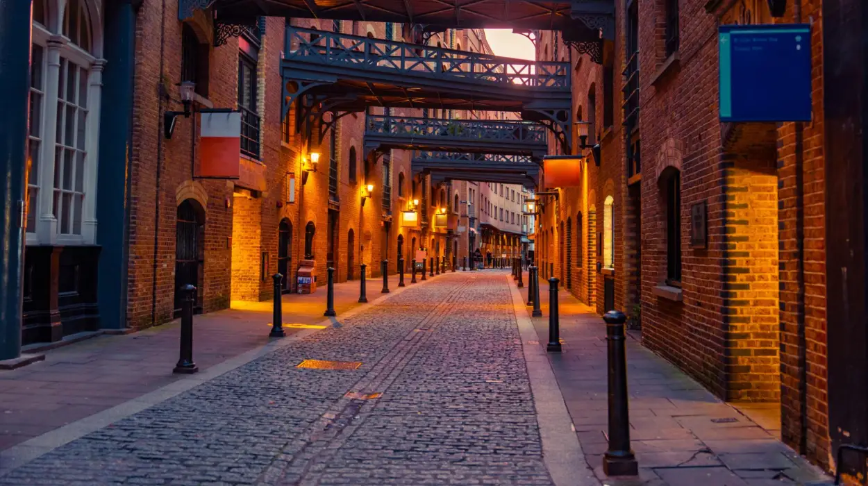
Goodwin’s Court near Covent Garden dates largely from the late seventeenth century following earlier medieval development. Its narrow proportions, timber-framed facades, traditional shopfronts, and historic lantern lighting preserve an unusually complete historic streetscape.
St Dunstan’s Court
Located near Fleet Street, St Dunstan’s Court developed around ecclesiastical and commercial activities associated with St Dunstan-in-the-West Church. Its confined layout demonstrates how medieval church precincts influenced surrounding urban form.
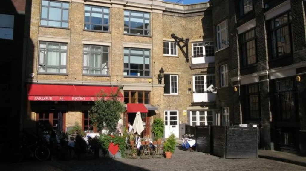
Bleeding Heart Yard
Bleeding Heart Yard combines Tudor origins with eighteenth-century redevelopment. Historical records connect the site with aristocratic residences before later industrial and residential use.
Pickering Place
Recognised as one of London’s smallest public squares, Pickering Place developed beside St James’s Palace during the eighteenth century. It became associated with coffee houses, gentlemen’s clubs, and reported duelling activity.
Bull and Mouth Street
Although largely altered through Victorian redevelopment, surviving sections reflect London’s coaching era when inns served long-distance travellers entering the capital.
Angel Court
Angel Court illustrates the commercial transformation of the City of London, where medieval access lanes evolved into office precincts while preserving historic street alignments.
Each location demonstrates how successive generations adapted existing urban spaces instead of replacing them completely.
How did medieval London shape today’s hidden street network?
Medieval London’s irregular planning established property divisions, market streets, parish boundaries, and commercial routes that still define many surviving alleys despite extensive rebuilding, creating one of Europe’s longest continuously occupied urban street systems.
Between the Norman Conquest in 1066 and the late fifteenth century, London experienced sustained commercial growth.
Population expanded from approximately 18,000 residents in the late eleventh century to more than 80,000 by 1300, making London England’s largest city.
Growth occurred incrementally. Instead of demolishing entire districts, new buildings occupied available plots. Individual landowners extended properties, creating narrow entrances leading toward workshops, gardens, warehouses, and riverside facilities.
Parish boundaries strongly influenced urban geography. Each parish maintained responsibility for local roads, drainage, and public order. These administrative divisions reinforced the long-term survival of many minor streets.
Markets specialising in fish, grain, meat, textiles, leather, and imported goods developed adjacent to particular churches or guild halls. Narrow connecting alleys efficiently linked merchants with storage facilities and Thames transport.
Even after medieval buildings disappeared, underlying street geometry remained remarkably stable because rebuilding followed inherited legal property boundaries.
Modern archaeological investigations conducted before construction projects consistently reveal medieval foundations directly beneath contemporary buildings.
How did disasters reshape London’s hidden alleys instead of erasing them?
Major disasters destroyed buildings but rarely eliminated London’s historic street network because reconstruction prioritised restoring commerce quickly while respecting established land ownership, producing remarkable continuity across successive rebuilding periods.
The Great Fire of 1666 remains the defining event in London’s urban history.
Beginning in Pudding Lane on 2 September 1666, the fire burned for four days before consuming approximately four-fifths of the medieval City.
Architect Christopher Wren proposed a rational grid inspired by continental European capitals. His plan included broad avenues, geometric intersections, and formal public squares.
Implementation proved impossible because ownership records identified thousands of individual landholders entitled to rebuild their properties.
Parliament therefore established rebuilding legislation that standardised construction materials while preserving original plots.
Brick and stone replaced timber, reducing future fire risks.
World War II produced another transformative period.
During the Blitz between September 1940 and May 1941, extensive bombing damaged historic districts across London. Nevertheless, planners increasingly recognised the heritage value of surviving streets.
Post-war reconstruction combined modern office buildings with preserved alley networks, allowing historic circulation patterns to remain visible within contemporary developments.
What architectural features distinguish London’s hidden alleys?
London’s hidden alleys preserve medieval proportions, Georgian brickwork, Victorian ironwork, historic paving, traditional signage, courtyards, and surviving commercial frontages that collectively document centuries of evolving architectural practices within constrained urban environments.
Architectural evidence allows historians to identify different development phases.
Medieval alleys typically feature irregular widths reflecting gradual expansion rather than planned construction.
Seventeenth-century rebuilding introduced uniform brick facades, sash windows, and improved fire-resistant materials.
Georgian improvements added elegant proportions, classical detailing, and orderly terraces without significantly widening existing streets.
Victorian engineering introduced cast-iron drainage systems, gas lighting, decorative street furniture, and improved paving surfaces.
Historic alley names frequently preserve occupational history.
Examples include:
- Bread Street reflecting medieval bakers.
- Ironmonger Lane representing metal traders.
- Milk Street recording dairy commerce.
- Poultry indicating poultry markets.
Many surviving courts contain enclosed courtyards that improved access, ventilation, and commercial organisation within densely developed neighbourhoods.
These architectural elements collectively preserve London’s historical evolution more effectively than isolated monuments because they demonstrate everyday urban development.
How do hidden alleys reveal London’s social and economic history?
Hidden alleys record London’s commercial expansion, occupational specialisation, immigration, religious diversity, publishing industry, and legal development by preserving locations where ordinary people worked, traded, worshipped, and formed local communities across successive centuries.
Urban history extends beyond royal palaces and government buildings.
Small streets reveal how ordinary Londoners experienced daily life.
Merchants imported international goods through Thames docks before distributing products via nearby warehouses.
Guild members regulated apprenticeships, production standards, and commercial competition from premises located within these districts.
Immigrant communities also influenced alley development.
French Huguenot refugees settled around Spitalfields after the seventeenth century, establishing internationally respected silk weaving industries.
Jewish communities contributed to commercial growth in eastern districts during subsequent centuries.
Printing houses concentrated around Fleet Street transformed London into Britain’s publishing centre.
Newspapers, books, pamphlets, and official documents circulated nationally through businesses operating from relatively modest premises connected by narrow passages.
Court records, parish registers, tax assessments, and trade directories provide detailed evidence of these evolving communities.
Such records remain invaluable resources for historians and genealogical researchers investigating family histories and occupational mobility.
How are London’s hidden alleys protected today?
Modern conservation policies protect London’s hidden alleys through listed building legislation, conservation area designation, archaeological regulation, heritage organisations, and planning controls that preserve historically significant streets while supporting continued public use and economic activity.
Heritage protection expanded significantly after the Second World War.
Listed building legislation identifies architecturally and historically important structures requiring special consent before alteration.
Conservation Areas preserve the broader historic character of streets rather than individual buildings alone.
Archaeological investigations accompany major redevelopment projects, ensuring historically significant remains receive appropriate documentation or preservation.
Local authorities regulate alterations affecting traditional paving, historic lighting, street furniture, shopfronts, and building facades.
Organisations including Historic England, the Museum of London Archaeology, local borough councils, and civic societies collaborate to document surviving historic environments.
Digital mapping projects increasingly combine archival documents, archaeological discoveries, historical maps, and modern geographic information systems to improve public understanding of London’s evolving landscape.
Tourism also supports preservation by encouraging continued investment in historic districts while promoting responsible public appreciation.
Why do London’s hidden alleys remain historically important today?
London’s hidden alleys remain historically important because they preserve authentic evidence of continuous urban development spanning Roman, medieval, Tudor, Georgian, Victorian, and modern periods while providing valuable educational, architectural, archaeological, and cultural resources for future generations.
Few world capitals preserve such extensive continuity within their everyday street network.
London’s hidden alleys demonstrate how cities evolve gradually through adaptation instead of complete replacement.
They preserve evidence unavailable through written records alone.
Building alignments reveal medieval land ownership.
Street names preserve forgotten occupations.
Architectural details illustrate technological advances.
Archaeological discoveries document changing patterns of trade, housing, sanitation, and public infrastructure.
For educators, these streets function as open-air historical laboratories.
For architects, they demonstrate sustainable adaptation across centuries.
For genealogists, parish boundaries and property records help reconstruct family histories.
For visitors, they provide direct physical connections with London’s historical development beyond its internationally recognised monuments.
What are London’s hidden alleys?
London’s hidden alleys are narrow historic lanes, courts, passages, and small streets that have survived from the medieval, Tudor, Georgian, and Victorian periods. Many retain their original layouts and reflect centuries of London’s urban development.