London’s historic streets preserve nearly 2,000 years of continuous urban development, reflecting Roman planning, medieval commerce, Tudor governance, Georgian expansion, Victorian engineering, and modern conservation. Their names, layouts, and surviving buildings document how political power, trade, religion, and everyday life shaped Britain’s capital.
- How did Roman Londinium establish the foundations of London’s streets?
- Why do many London street names describe medieval occupations and daily life?
- How did London’s markets influence the development of famous streets?
- Why did the Great Fire of 1666 fail to erase London’s medieval street pattern?
- Which historic streets best represent different eras of London’s development?
- How are London’s historic streets protected for future generations?
- What do London’s historic streets teach about the city’s identity today?
London is one of the oldest continuously inhabited cities in Europe. Its street network forms a living historical record rather than a planned modern grid. Unlike cities rebuilt from scratch after disasters, much of London’s street pattern evolved gradually. The result is an urban landscape where Roman roads intersect medieval alleys, Georgian squares connect with Victorian thoroughfares, and centuries of adaptation remain visible.
The city’s origins date to approximately AD 47 when the Romans established Londinium on the north bank of the River Thames. Roman surveyors designed straight roads leading to defensive walls, administrative buildings, markets, and river crossings. Several modern streets still follow these original alignments, demonstrating remarkable continuity across almost two millennia.
The Norman Conquest in 1066 reinforced London’s importance as England’s political and commercial centre. Medieval guilds, religious institutions, royal officials, and merchants expanded the city while preserving many earlier routes. Streets gradually acquired names that described occupations, nearby landmarks, or geographical characteristics. These names became permanent historical records.
The Great Fire of 1666 destroyed approximately 13,200 houses, 87 parish churches, and numerous public buildings across the medieval City of London. Although architect Sir Christopher Wren proposed a rational grid system, rebuilding largely followed existing property boundaries because land ownership rights remained legally protected. Consequently, London’s medieval street pattern survived despite widespread destruction.
During the eighteenth and nineteenth centuries, London’s population expanded from around 630,000 people in 1715 to more than 6.5 million by 1901. New districts emerged, but historic streets continued functioning as commercial centres, ceremonial routes, and residential neighbourhoods. Conservation policies introduced during the twentieth century helped preserve significant streets and architectural features.
Today, London’s historic streets remain valuable cultural assets. Archaeological excavations, conservation areas, listed buildings, and heritage legislation ensure that these routes continue illustrating Britain’s social, political, architectural, and economic history.
How did Roman Londinium establish the foundations of London’s streets?
Roman engineers established London’s earliest permanent street network around AD 47 using surveyed roads, defensive planning, and commercial infrastructure. Several major modern routes follow Roman alignments, preserving the original framework that supported administration, military logistics, river trade, and urban growth.
Roman Londinium developed rapidly after the Roman conquest of Britain under Emperor Claudius. Engineers selected the site because the River Thames provided a navigable crossing point linking southeastern Britain with continental Europe. The settlement became an administrative and commercial centre within the Roman province of Britannia.
Roman surveyors employed precise engineering methods to create straight roads connecting Londinium with other settlements. Important highways included routes leading toward Verulamium (modern St Albans), Camulodunum (Colchester), Silchester, and Canterbury. These roads carried military units, merchants, government officials, and supplies throughout Roman Britain.
Within the city walls, Roman streets formed a relatively organised network. Excavations conducted by the Museum of London Archaeology have uncovered stone-paved roads, drainage systems, timber walkways, and public buildings demonstrating sophisticated urban planning.
Several modern streets preserve Roman alignments. Cannon Street follows the approximate route connecting the Roman forum with the western city. Watling Street commemorates one of Britain’s principal Roman highways extending toward Dover. Bishopsgate developed near a Roman gate leading northward beyond the city walls.
Roman London’s defensive wall, constructed around AD 200, stretched approximately 3 kilometres. Gates including Aldgate, Ludgate, Bishopsgate, Newgate, Cripplegate, Moorgate, and Aldersgate became permanent reference points influencing street development throughout the medieval period.
Although Roman administration ended during the early fifth century, surviving roads remained practical transportation corridors. Later inhabitants reused these routes because rebuilding completely new infrastructure required enormous resources.
Why do many London street names describe medieval occupations and daily life?
Many historic London street names originated during the medieval period because authorities identified streets according to dominant trades, local markets, religious institutions, geographical features, or nearby landmarks. These names preserve valuable evidence about economic organisation and everyday urban activity.
Medieval London expanded into a highly specialised commercial city governed by guilds and regulated markets. Individual trades frequently concentrated within particular streets, simplifying taxation, regulation, apprenticeship, and customer access.
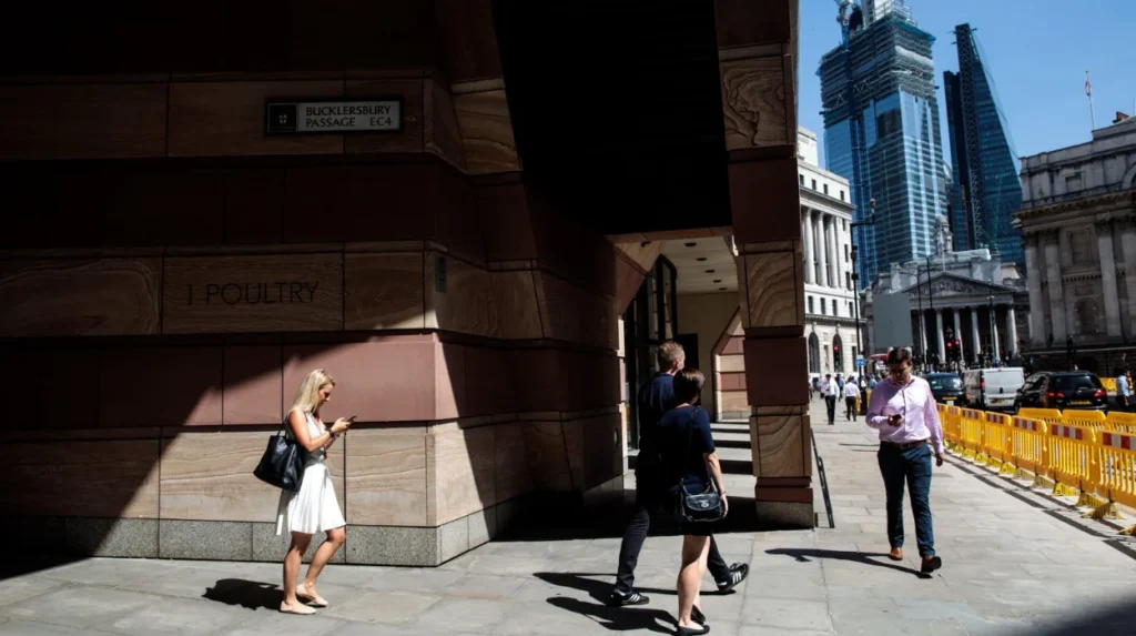
Bread Street became associated with bakers selling bread under regulated prices. Milk Street developed around dairy vendors. Honey Lane reflected merchants trading honey and related products. Poultry marked an important market selling chickens, ducks, geese, and eggs. Ironmonger Lane identified metal traders, while Wood Street served timber merchants.
Threadneedle Street acquired its name through textile merchants selling thread and sewing materials. Cheapside originated from the Old English word “chepe,” meaning market. Rather than describing inexpensive goods, the name referred to London’s principal medieval marketplace.
Lombard Street reflected the presence of Italian merchants and bankers from Lombardy who introduced sophisticated financial practices into medieval England. Their commercial expertise contributed significantly to London’s emergence as a European financial centre.
Religious institutions also shaped street names. Monasteries, churches, hospitals, and priories owned substantial urban property. Amen Corner, Paternoster Row, and Ave Maria Lane reflected Christian religious practices associated with nearby St Paul’s Cathedral.
Topographical characteristics influenced naming conventions as well. Fleet Street derived its name from the River Fleet, one of London’s now largely subterranean rivers. Strand originated from the Old English word for riverbank because it once bordered the Thames before extensive land reclamation.
These names survived because successive generations continued recognising established locations. Modern visitors therefore encounter medieval economic geography preserved through everyday navigation.
How did London’s markets influence the development of famous streets?
Historic markets transformed London’s streets into specialised commercial districts where merchants, craftsmen, wholesalers, and consumers interacted daily. These concentrated trading environments shaped street names, building designs, transport networks, and London’s position as England’s principal economic centre.
Markets formed the economic foundation of medieval and early modern London. Royal charters granted trading privileges while civic authorities regulated prices, quality standards, weights, and measures.
Cheapside functioned as London’s premier commercial avenue for centuries. Merchants sold textiles, jewellery, spices, imported goods, and luxury products alongside essential household supplies. Royal processions frequently travelled through Cheapside because it represented London’s wealth and civic importance.
Smithfield developed as England’s largest livestock market. Farmers transported cattle, sheep, horses, and pigs from surrounding counties for sale. The market also became associated with tournaments, public gatherings, and significant historical events.
Leadenhall evolved from a medieval manor into a major covered market specialising in poultry, meat, leather, wool, and imported commodities. Its strategic location near the eastern commercial districts encouraged wholesale distribution throughout the city.
Billingsgate became London’s principal fish market because of its riverside location on the Thames. Fresh seafood arrived daily from coastal fishing communities before distribution across London.
Covent Garden emerged during the seventeenth century as London’s primary fruit and vegetable market after urban redevelopment by the Earl of Bedford. The surrounding streets filled with traders, porters, coffee houses, theatres, and artisans.
Markets encouraged supporting industries. Warehouses, inns, coaching yards, counting houses, and workshops clustered nearby, increasing commercial density and reinforcing London’s economic dominance.
To experience these historic trading districts in person today, consult our comprehensive [Best Self-Guided Walking Tours Across London for Every Curious First-Time Visitor] for itineraries and visiting parameters.
Why did the Great Fire of 1666 fail to erase London’s medieval street pattern?
The Great Fire destroyed thousands of buildings but preserved most medieval street alignments because legal property ownership required rebuilding along existing boundaries. Financial realities and parliamentary decisions prevented complete urban redesign despite ambitious reconstruction proposals.
The Great Fire began on 2 September 1666 in Pudding Lane and burned for four days. Approximately 373 acres of the City of London were destroyed. More than 70,000 residents lost homes or workplaces.
Architects including Sir Christopher Wren, John Evelyn, and Robert Hooke proposed comprehensive rebuilding plans featuring broad boulevards, geometric street layouts, and organised public squares inspired by continental European cities.
These visionary plans proved impractical because thousands of individual property owners retained legal ownership despite fire damage. Redrawing boundaries required complex compensation agreements that government authorities could not implement quickly.
Parliament prioritised rapid economic recovery. The Rebuilding of London Act 1667 established construction standards including wider streets in selected areas, brick and stone building materials, and improved fire safety regulations. However, the legislation largely respected existing property divisions.
Consequently, narrow medieval streets including Cornhill, Gracechurch Street, Cannon Street, and Lombard Street retained familiar alignments despite extensive rebuilding.
Christopher Wren’s redesigned St Paul’s Cathedral became the architectural centrepiece of post-fire London. Numerous parish churches also rose in new architectural styles while occupying earlier religious sites.
The survival of medieval street patterns after the Great Fire remains one of London’s defining historical characteristics. Walking through the City today reveals street layouts that predate both the Tudor monarchy and the Renaissance.
Which historic streets best represent different eras of London’s development?
Several streets illustrate distinct historical periods through their architecture, street patterns, institutions, and cultural significance. Together they demonstrate London’s transformation from Roman settlement into medieval trading city, imperial capital, financial centre, and modern global metropolis.
Fleet Street symbolises centuries of communication. Initially following the River Fleet, it later became synonymous with Britain’s newspaper industry after national newspapers established headquarters there during the nineteenth and twentieth centuries.
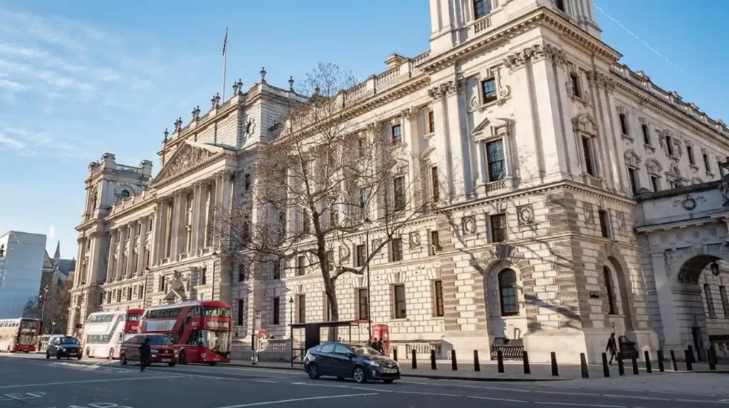
Whitehall reflects royal and governmental authority. Following the destruction of Whitehall Palace in 1698, the area evolved into Britain’s administrative centre housing major government departments.
The Strand illustrates aristocratic development along the Thames. Wealthy noble families built grand residences between Westminster and the City before commercial redevelopment transformed the district during later centuries.
The Mall emerged as a ceremonial avenue linking royal residences and eventually forming part of Britain’s state procession route.
Piccadilly developed during the seventeenth century after tailor Robert Baker manufactured fashionable lace collars known as piccadills. The surrounding district became associated with affluent housing, clubs, hotels, and retail businesses.
Regent Street represents nineteenth-century urban planning under architect John Nash. Constructed between 1814 and 1825, it connected Regent’s Park with St James’s while introducing elegant unified architecture.
Oxford Street evolved from the Roman road leading toward Oxford before becoming one of Europe’s busiest shopping streets during the nineteenth century.
Each street demonstrates changing priorities including defence, commerce, governance, transportation, retail, and ceremonial functions across successive historical eras.
How are London’s historic streets protected for future generations?
London protects historic streets through conservation areas, listed building legislation, archaeological investigation, planning controls, and heritage organisations. These coordinated measures preserve architectural character, historical evidence, and cultural significance while accommodating modern urban development.
Heritage conservation became increasingly important during the twentieth century as redevelopment threatened historic neighbourhoods. The Planning (Listed Buildings and Conservation Areas) Act 1990 established legal protection for buildings and designated conservation areas throughout England.
Greater London contains hundreds of conservation areas protecting historically significant streetscapes. Local planning authorities regulate alterations affecting architectural appearance, public spaces, street furniture, and historic character.
Historic England maintains the National Heritage List for England, recording listed buildings according to historical and architectural importance. Grade I, Grade II*, and Grade II designations ensure statutory protection.
Archaeological investigations frequently accompany major construction projects within the City of London. Excavations have uncovered Roman roads, medieval workshops, Saxon cemeteries, Tudor waterfront structures, and Victorian infrastructure, expanding scholarly understanding of London’s evolution.
The London Metropolitan Archives preserve maps, property deeds, parish records, tax documents, and municipal registers documenting centuries of street development. These collections support historians, genealogists, planners, and conservation specialists.
Public institutions including museums, universities, local history societies, and educational organisations continue researching London’s urban history through interdisciplinary scholarship combining archaeology, architecture, geography, and documentary evidence.
Modern infrastructure upgrades carefully balance heritage preservation with contemporary transport, environmental sustainability, accessibility, and economic requirements. This approach allows historic streets to remain active parts of everyday London while retaining their exceptional historical value.
What do London’s historic streets teach about the city’s identity today?
London’s historic streets demonstrate how continuous adaptation preserved the city’s physical memory across Roman, medieval, Tudor, Georgian, Victorian, and modern periods. Their surviving names, layouts, and buildings provide enduring evidence of Britain’s political, commercial, architectural, and cultural development.
Few world capitals retain such extensive physical continuity across two millennia. London’s streets illustrate that urban history is recorded not only in monuments but also in everyday routes used by residents, workers, visitors, and institutions.
Every surviving street reflects multiple historical layers. Roman engineering established foundational routes. Medieval merchants assigned occupational names. Tudor governance strengthened civic administration. Post-fire rebuilding introduced improved construction standards. Georgian expansion reshaped residential districts. Victorian engineering modernised transport and sanitation. Contemporary conservation protects this accumulated heritage.
Historic streets also preserve intangible cultural heritage. Street names record forgotten occupations, vanished rivers, medieval markets, religious traditions, immigrant communities, and commercial specialisations. These linguistic survivals enrich historical interpretation and strengthen London’s distinctive identity.
For educators, these streets function as open-air classrooms illustrating urban planning, archaeology, architecture, economics, and political history. For genealogists, parish boundaries, property records, and street directories help reconstruct family histories. For cultural tourists, historic streets provide authentic connections with the city’s past.
Ongoing archaeological discoveries continue refining historical understanding. New excavations regularly reveal additional evidence beneath familiar roads, demonstrating that London’s historic landscape remains an active field of research rather than a completed historical narrative.
The origins of London’s historic streets therefore extend beyond physical infrastructure. They represent an unbroken record of human activity spanning nearly 2,000 years. Preserving these streets ensures that future generations can continue exploring how one settlement on the River Thames evolved into one of the world’s most influential cities.
What is the oldest street in London?
There is no single officially recognised oldest street, but Watling Street is among London’s oldest surviving routes. It originated as a Roman road, and parts of its alignment have remained in continuous use for nearly 2,000 years.