The Strand is one of London’s most historically concentrated streets. Running between Trafalgar Square and Temple Bar, it preserves the physical trace of the route that linked the royal and political centre of Westminster to the mercantile City of London. Across roughly one mile, the street contains medieval foundations, Tudor power politics, Stuart rebuilding, Georgian churches, Victorian institutions, theatres, hotels, publishing sites, and twentieth-century cultural reinvention. For anyone planning a self-guided heritage walk, the Strand offers one of the clearest ways to understand how London developed as a capital.
- What is the Strand and why is it important in London’s history?
- How did the Strand develop from a riverside route into a grand London thoroughfare?
- Which vanished palaces shaped the Strand before the modern street emerged?
- Somerset House and the destruction of the medieval parish landscape
- Savoy Palace and the memory of aristocratic violence
- Arundel House, Essex House, and the fragmentation of elite estates
- Durham House and political tenancy
- What can visitors see at Somerset House and why is it central to any Strand walk?
- Why do St Mary le Strand and St Clement Danes matter so much on this route?
- St Mary le Strand: a church rebuilt after aristocratic displacement
- St Clement Danes: medieval origin, Wren rebuilding, and RAF memorial role
- How did the Strand become a centre of law, government, and education?
- What role did theatres, hotels, and restaurants play in the Strand’s cultural life?
- What is the best self-guided walking route along the Strand for history visitors?
- Stop 1: Charing Cross and the western threshold
- Stop 2: St Martin’s influence and the approach to the Strand proper
- Stop 3: St Clement Danes
- Stop 4: The Savoy precinct and Savoy-related survivals
- Stop 5: Adelphi and surviving estate geography
- Stop 6: Somerset House
- Stop 7: St Mary le Strand and Aldwych
- Stop 8: King’s College London, Bush House, and the academic Strand
- Stop 9: Temple Bar and the eastern threshold
- What survives today of the Strand’s historic past, and why does preservation matter here?
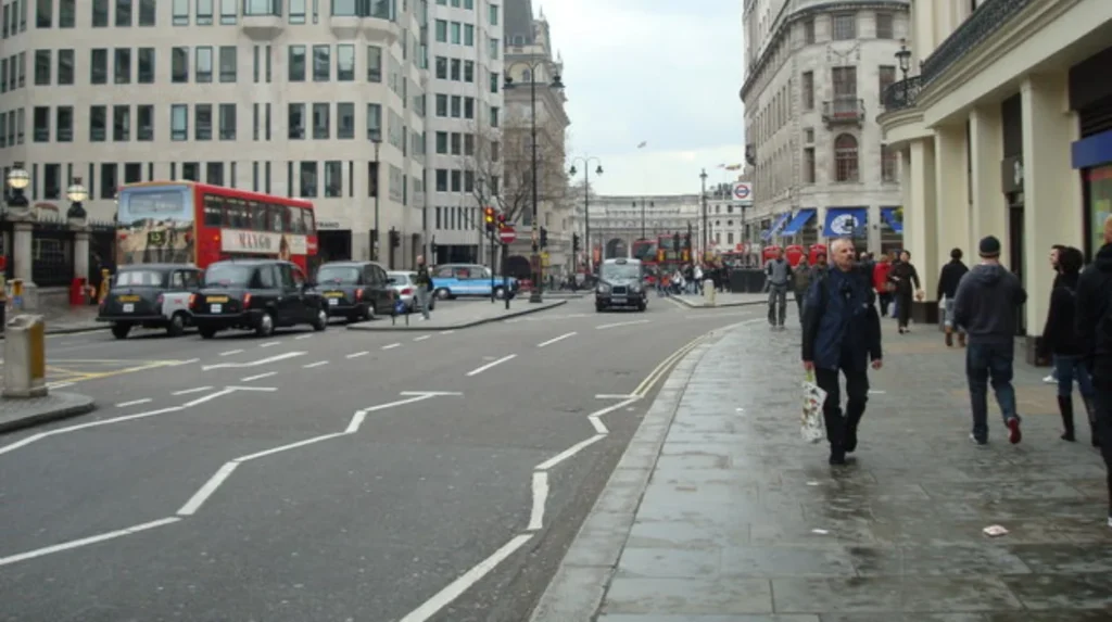
Today, the Strand belongs to the City of Westminster and sits within central London’s West End. Historically, however, it was a riverside corridor lined with aristocratic houses and ecclesiastical foundations because the River Thames lay much closer to its southern edge before the construction of the Victoria Embankment in the nineteenth century. The street’s name comes from the Old English strond, meaning shore or riverbank. That etymology is not decorative detail. It explains why so many great houses once faced south with private stairs to the water and why the Strand became a prestigious address long before it became a traffic route.
For modern visitors, the Strand works especially well as a walking itinerary because the surviving buildings still reveal successive layers of London history in close sequence. A walk can begin at the western end near Charing Cross and move east toward Temple Bar, or the route can be reversed depending on arrival point. Either way, the route allows walkers to move from royal and aristocratic London to legal, educational, ecclesiastical, commercial, and theatrical London in a single continuous line. To experience this historic district in person today, consult our comprehensive [How The Strand Became One of London’s Most Historic Streets] for itineraries and visiting parameters.
What is the Strand and why is it important in London’s history?
The Strand is the historic road connecting Westminster and the City of London. It became important because it sat beside the Thames, attracted aristocratic palaces from the medieval period onward, and later concentrated churches, theatres, hotels, legal institutions, publishing houses, and cultural landmarks within a single ceremonial and commercial corridor.
The Strand matters because it records the transformation of London from a set of neighbouring settlements into a single metropolitan capital. In the medieval period, Westminster and the City of London were separate centres of power. Westminster contained the royal palace, abbey, and institutions of crown government. The City was the financial and mercantile core, governed by its own civic authorities and sustained by international trade. The road between them therefore, carried courtiers, clergy, lawyers, merchants, diplomats, servants, and goods. Over centuries, traffic between those two centres generated one of the most important urban corridors in England.
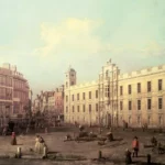
Its significance also comes from land use. From the twelfth century onward, major households established residences along the Strand because it offered access both to Westminster politics and to the river. Before embankment works altered the shoreline, the Thames lapped much closer to the south side of the street. Noble houses and episcopal residences used river stairs as practical entrances because boat travel was often faster than road transport in London. This explains why the Strand became lined with large compounds rather than the continuous commercial frontage seen today.
The street also became a zone of institutional transition. When many aristocratic houses disappeared between the seventeenth and nineteenth centuries, the Strand did not decline into irrelevance. Instead, it acquired new roles. It became associated with law through the nearby Inns of Court and the later Royal Courts of Justice district; with religion through churches such as St Clement Danes and St Mary le Strand; with print and journalism through its proximity to Fleet Street; with hospitality through hotels and restaurants such as the Savoy and Simpson’s; and with education and government through Somerset House and King’s College London.
For heritage interpretation, the Strand is therefore not a single-era site. It is a sequence of overlapping historical functions. Each surviving building is easier to understand when placed within that longer urban process.
How did the Strand develop from a riverside route into a grand London thoroughfare?
The Strand began as a shoreline route beside the Thames and developed into a major thoroughfare as Westminster expanded, noble households built riverside palaces, and London’s street network intensified. Nineteenth-century embankment works then pushed the river southward and fixed the Strand as an urban boulevard rather than a waterside road.
The earliest identity of the Strand was geographical. It followed slightly higher ground beside the river and formed part of the route between the ancient City and Westminster. The name appears in early medieval records and reflects that waterside setting. In practical terms, the road served travellers moving west from the City and east from Westminster, but it was never just a transit line. It also bordered a zone of gardens, religious houses, and great residences.
By the later Middle Ages and the Tudor period, the Strand had become a prestigious address because England’s political elite wanted proximity to the court. The road’s southern side in particular contained mansions and palaces with substantial grounds. These included Somerset House, Durham House, Worcester House, Arundel House, Essex House, and Savoy Palace in earlier phases. Several were linked to bishops, nobles, or royal officials. Their occupants used the Strand as a land route and the Thames as a private transport corridor. The street therefore functioned as a political frontage.
Urban change accelerated after the dissolution of monasteries, the redistribution of church lands, and the growth of central government under the Tudors and Stuarts. Some houses were rebuilt, subdivided, or transferred to new owners. By the seventeenth century, the area had become more densely developed, and side streets such as Essex Street and Arundel Street preserved the memory of earlier palace estates even after the main houses vanished.
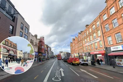
The most decisive physical transformation came in the nineteenth century. The construction of the Victoria Embankment between the 1860s and 1870s reclaimed land from the Thames, created a new riverside roadway, improved sewage and transport infrastructure, and permanently changed the Strand’s relationship to the water. Buildings that had once stood near the river were now separated from it by embankment land and modern roads. The Strand stopped reading as a shoreline and became the inland urban artery known today.
That change is crucial for walkers. The present street pattern can make it difficult to imagine the Strand’s former riverside status, so any heritage walk should actively reconstruct the missing river edge in the mind’s eye.
Which vanished palaces shaped the Strand before the modern street emerged?
The medieval and Tudor Strand was shaped by great riverside residences including Somerset House, Durham House, Arundel House, Essex House, and Savoy Palace. Most disappeared through demolition, rebuilding, or subdivision, but their former estates still determine side streets, plot lines, and institutional sites along the route.
The Strand’s most important lost landscape was its chain of palaces and mansions. These buildings turned the street into an elite residential corridor and explain why the area retained political and social prestige for centuries. Although most no longer stand, their former locations remain essential waypoints on a historical walk.
Somerset House and the destruction of the medieval parish landscape
The first Somerset House was built between 1547 and 1552 for Edward Seymour, Duke of Somerset and Lord Protector during the minority of Edward VI. To clear the site, the earlier parish church of St Mary le Strand was demolished. That act reveals the power dynamics of Tudor London. Great men could reorder the local landscape, displace parish structures, and remake the river frontage for aristocratic display. The current Somerset House is not Seymour’s building, but the site’s importance begins with that Tudor intervention.
Savoy Palace and the memory of aristocratic violence
The Savoy was one of the grandest noble residences in medieval England. Associated with John of Gaunt, Duke of Lancaster, it stood west of the main Strand stretch near today’s Savoy complex. In 1381, during the Peasants’ Revolt, the palace was attacked and destroyed by rebels. Its destruction became one of the most famous episodes of urban violence in medieval London. The later Savoy Hospital and Savoy Chapel preserved the site’s significance, even though the medieval palace itself vanished.
Arundel House, Essex House, and the fragmentation of elite estates
Arundel House and Essex House occupied large stretches of the Strand’s southern side. Arundel House became associated with the Howard family and with collecting and scholarship; the so-called Arundel Marbles are one reminder of that cultural world. Essex House, rebuilt from an earlier property and later associated with Robert Devereux, Earl of Essex, gave its name to Essex Street after demolition and redevelopment. These houses disappeared, but their names survive in the street plan. For historians, those street names are not incidental. They are evidence of estate fragmentation and urban redevelopment.
Durham House and political tenancy
Durham House originated as the London residence of the bishops of Durham and later housed politically important tenants. It stood near the present Adelphi and Victoria Embankment approaches. Like other Strand houses, it demonstrates how ecclesiastical and aristocratic property overlapped in central London. Over time the building declined, was subdivided, and disappeared, but it left a strong documentary trace in political history and in maps of the Tudor and Stuart city.
A Strand walking guide should therefore treat absence as historical evidence. The lost palaces explain the scale of the street, the irregular survival of courts and side lanes, and the unusual concentration of institutional sites on former private estates.
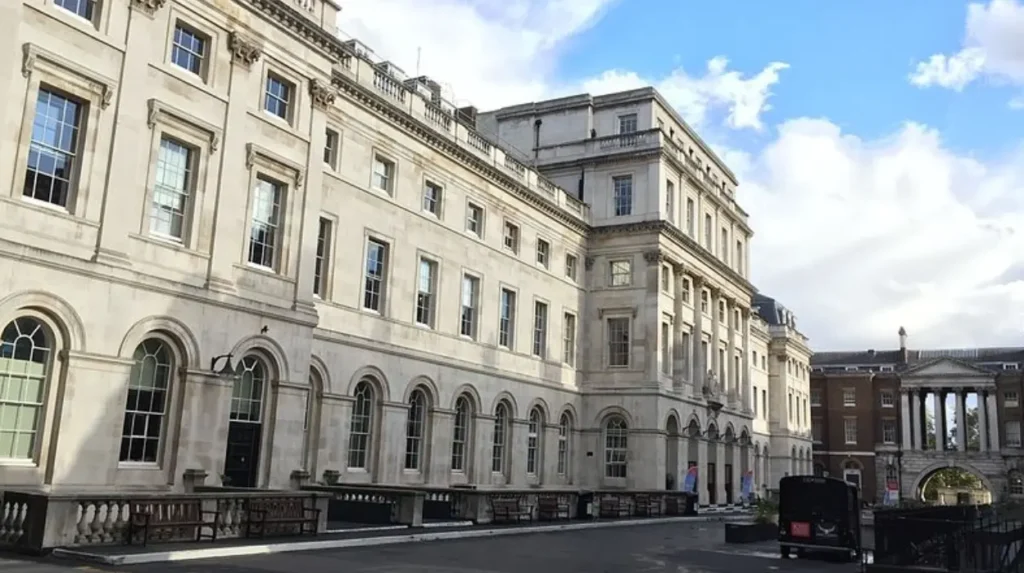
What can visitors see at Somerset House and why is it central to any Strand walk?
Somerset House is the Strand’s defining surviving complex because it embodies Tudor ambition, Georgian state building, and modern cultural reuse. The present neoclassical structure replaced earlier royal and aristocratic buildings and later housed government offices before becoming one of London’s major arts and heritage venues.
Somerset House is the architectural anchor of the Strand. The current building was begun in the 1770s to designs associated with Sir William Chambers after earlier rebuilding campaigns and changes of use on the Tudor site. It was conceived as a large state complex with an imposing riverfront and an equally monumental Strand frontage. The building’s scale makes visible the eighteenth-century state’s confidence in ordered classical architecture.
Its historical importance lies in layered use. After the Tudor Somerset House had passed through royal occupation and various adaptations, the eighteenth-century rebuilding created offices for public administration and learned institutions. Over time Somerset House housed parts of the Navy Board, tax offices, the Stamp Office, and the Registrar General’s department, among others. The site therefore moved from aristocratic and royal display to bureaucratic government. That shift mirrors the growth of the modern British state.
For cultural history, Somerset House is also associated with the Royal Academy in its early years and with the wider eighteenth-century institutionalisation of art and public culture. In the present day it operates as a cultural centre with exhibitions, public events, and a courtyard that is heavily used by Londoners and visitors. This modern reuse is historically significant because it preserves a state complex through public access rather than administrative occupation.
Architecturally, walkers should pay attention to the disciplined neoclassical composition, the axial relationship between the Strand entrance and the river terrace, and the way the building masks the violence of its origin: the demolition of the medieval church of St Mary le Strand and the appropriation of riverside land by Tudor power. Somerset House is not just beautiful architecture. It is a monument to changing ownership of urban space.
Why do St Mary le Strand and St Clement Danes matter so much on this route?
St Mary le Strand and St Clement Danes are the Strand’s two most important churches because they preserve the street’s religious, architectural, and memorial history. Together they connect medieval parish life, post-Fire rebuilding, eighteenth-century church building policy, war damage, and modern ceremonial remembrance.
The Strand’s churches do more than punctuate the route visually. They explain how parish life survived beside aristocratic estates, how London rebuilt after catastrophe, and how sacred buildings acquired national commemorative roles.
St Mary le Strand: a church rebuilt after aristocratic displacement
St Mary le Strand stands near Somerset House and is one of the most striking Baroque churches in London. Designed by James Gibbs and built between 1714 and 1724, it was the first of the churches erected under the early eighteenth-century Commission for Building Fifty New Churches. Its existence is directly tied to the earlier destruction of the medieval parish church for Somerset House. The new building therefore represents both restitution and state-backed church expansion.
Architecturally, it is important as an early major London work by Gibbs, whose design combines sculptural massing, a richly handled steeple, and a dramatic urban presence. Historically, the church has connections to notable individuals, including the marriage of Charles Dickens’s parents. For many years it sat marooned by traffic, which encouraged the nickname “St Mary-in-the-Strand” in a literal sense. Recent public realm changes around Aldwych and the Strand have improved pedestrian access and restored some dignity to its setting.
St Clement Danes: medieval origin, Wren rebuilding, and RAF memorial role
St Clement Danes stands farther west and has an older foundation. The church existed in the medieval period and is traditionally linked to a much earlier origin, though the current building is principally the result of rebuilding by Sir Christopher Wren after the Great Fire era. Wren’s work and later modifications created the church seen today. Its tower and spire are prominent markers on the street.
The church’s modern identity is closely connected to the Royal Air Force. It was badly damaged during the Blitz and later restored as the Central Church of the RAF, reconsecrated in 1958. This gives the building a dual significance: it is both a parish church in the historical landscape of the Strand and a national war memorial space. The surrounding statuary and commemorative elements reinforce that role.
Taken together, St Mary le Strand and St Clement Danes allow a walker to read three centuries of London church history: medieval parish continuity, post-1666 rebuilding, eighteenth-century expansion, wartime destruction, and memorial restoration.
How did the Strand become a centre of law, government, and education?
The Strand became a centre of law, government, and education because its position between Westminster and the City attracted state offices, legal institutions, and learned bodies. Nearby Inns of Court, Somerset House’s administrative functions, King’s College London, and the Royal Courts district reinforced that concentration.
The Strand’s institutional identity developed gradually from geography and prestige. Because it linked Parliament and Whitehall to the City, it naturally attracted offices that needed access to both. Somerset House became the clearest example, housing state departments on a scale that made the Strand part of the machinery of government rather than merely a residential quarter.
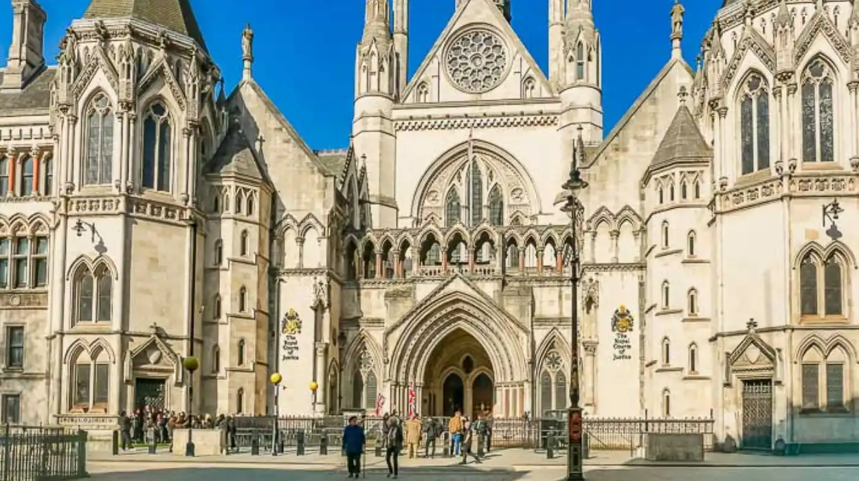
Legal culture also shaped the eastern end of the route. Temple Bar marked the ceremonial boundary between the City of London and Westminster. Just south of the Strand lie the Inner Temple and Middle Temple, two of the Inns of Court that trained and housed barristers. Their proximity meant that lawyers, clerks, printers, and clients moved through the Strand constantly. The later construction of the Royal Courts of Justice on the north side of the broader corridor, just off the Strand on the Strand-Fleet Street axis, intensified the district’s legal identity in the nineteenth century.
Education added another layer. King’s College London, founded in 1829, established one of its principal campuses on the Strand. The institution transformed parts of the area into a place of teaching, scholarship, and student life. Bush House and related buildings, now also associated with King’s, further extend that academic presence. For walkers, this means the Strand is not a fossilised heritage strip. It remains a working intellectual district.
This combination of law, administration, and education matters for interpretation because it explains the mixed character of the buildings. On one stretch, a walker encounters a ceremonial church; on another, a major college frontage; on another, access to legal precincts. The Strand’s complexity is the product of institutional accumulation, not random urban clutter.
What role did theatres, hotels, and restaurants play in the Strand’s cultural life?
The Strand became a cultural corridor because entertainment, hospitality, and dining clustered around its central location. Theatres, the Savoy, Simpson’s in the Strand, and nearby music and publishing venues turned the street into a place where politics, literature, performance, journalism, and tourism overlapped from the eighteenth century onward.
The Strand’s cultural life grew from its traffic and prestige. A road used by elites, officials, lawyers, and visitors naturally attracted services and amusements. By the eighteenth and nineteenth centuries, the surrounding district had become one of London’s most active theatrical and hospitality zones.
The Savoy is the most internationally recognised example. The Savoy Hotel, opened in 1889 by Richard D’Oyly Carte, brought luxury hospitality to the Strand on a new scale. It formed part of a broader Savoy complex connected to the nearby Savoy Theatre, itself significant in the history of electric lighting and in the performance of the comic operas of Gilbert and Sullivan. The Savoy therefore represents more than a hotel brand. It marks the Strand’s place in late Victorian entertainment, technological modernity, and elite urban consumption.
Simpson’s in the Strand, founded in 1828, became another long-standing institution. It began as a chess-oriented coffee house and developed into one of London’s best-known traditional dining rooms. Its clientele included writers, politicians, and public figures. Even when such establishments changed ownership or temporarily closed, their endurance helped preserve the Strand’s reputation as a place where cultural and social life mixed.
The theatre district around the Strand and Aldwych further strengthened this identity. Venues in and around the street connected the Strand to the wider West End stage economy. At the same time, the nearby Fleet Street press world and the publishing culture of central London meant that journalists, editors, actors, lawyers, and politicians all circulated through the same geography. That overlap is one reason the Strand appears so frequently in literary and social histories of London.
For a walking guide, these cultural institutions are essential because they show how the street evolved after the disappearance of aristocratic palaces. The Strand did not lose importance when the noble houses vanished. It converted status into commercial and cultural capital.
What is the best self-guided walking route along the Strand for history visitors?
The most effective self-guided Strand route runs from Charing Cross east to Temple Bar because it follows the historical movement from royal Westminster toward the legal and mercantile city. This direction allows visitors to encounter churches, hotels, theatres, Somerset House, college buildings, and former palace sites in a clear chronological sequence.
A practical historical walk can be completed in roughly 90 minutes without museum visits, or in three to four hours with stops for interiors, exhibitions, and detours. The key is to read the street not simply as a list of buildings but as a progression of historical layers.
Stop 1: Charing Cross and the western threshold
Begin near Charing Cross, historically associated with the route into Westminster and with the ceremonial geography of central London. This starting point helps orient the walker between Trafalgar Square, Whitehall, and the Strand.
Stop 2: St Martin’s influence and the approach to the Strand proper
Although not on the Strand itself, the immediate context of Charing Cross and St Martin’s-in-the-Fields helps explain the western civic and ecclesiastical setting. From there, enter the Strand eastward.
Stop 3: St Clement Danes
Pause at St Clement Danes to examine the church’s Wren-era rebuilding, wartime damage, and RAF memorial role. This is one of the clearest points at which the Strand’s religious and national commemorative histories intersect.
Stop 4: The Savoy precinct and Savoy-related survivals
Move through the Savoy area, noting the long continuity of elite occupation, from medieval Savoy Palace to the later Savoy institutions and the nineteenth-century hotel and theatre complex. This is the best place to discuss the Strand’s cultural reinvention.
Stop 5: Adelphi and surviving estate geography
The Adelphi area and nearby side streets preserve traces of estate redevelopment and Georgian urban planning. Even where original palaces are gone, the street names and plot alignments tell the story of aristocratic land turned into speculative and institutional London.
Stop 6: Somerset House
Spend the longest stop at Somerset House. Its courtyard, façade, and river terrace allow the walker to reconstruct the Strand’s transformation from Tudor palace ground to Georgian administrative complex to modern arts venue.
Stop 7: St Mary le Strand and Aldwych
Cross to St Mary le Strand to understand the replacement of the demolished medieval parish church and the eighteenth-century campaign for new London churches. The recent improvement of the public realm around Aldwych also offers a useful example of contemporary heritage-led urban design.
Stop 8: King’s College London, Bush House, and the academic Strand
Continue east past the King’s College London campus and associated institutional buildings. This stretch demonstrates the Strand’s educational and twentieth-century broadcasting associations, especially around Bush House and the BBC World Service legacy.
Stop 9: Temple Bar and the eastern threshold
Finish at the eastern end near Temple Bar, where the Strand historically approached the City and the legal quarter. This is the correct place to discuss the boundary between Westminster and the City and the role of the nearby Temple precincts in English legal culture.
This route works because it moves from broad urban context to specific institutions while keeping the walker on a single intelligible line.
What survives today of the Strand’s historic past, and why does preservation matter here?
The Strand preserves its past through churches, Somerset House, institutional buildings, street names, theatre and hotel sites, and the street alignment itself. Preservation matters because the area demonstrates how London’s political, religious, educational, and cultural history accumulated in one corridor rather than in isolated monuments.
The most obvious survivals are architectural: Somerset House, St Mary le Strand, St Clement Danes, the Savoy-related complex, and major educational and commercial buildings. Yet the Strand’s historical value also depends on less visible survivals. Street names such as Essex Street and Arundel Street preserve the memory of vanished palaces. The alignment of lanes, courts, and frontages reflects centuries of estate division. The route of the street itself still follows the ancient connection between Westminster and the City.
Preservation on the Strand therefore requires more than protecting individual façades. It requires protecting historical intelligibility. Public realm improvements, pedestrian access, interpretation panels, church opening hours, and careful redevelopment all influence whether visitors can still read the street as a layered historical document. Recent changes around Aldwych and St Mary le Strand show how traffic-dominated environments can be rebalanced to reveal architectural heritage more clearly.
For historians, educators, and genealogical researchers, the Strand is also valuable because it intersects with documentary records. Parish registers, legal archives, institutional records, newspapers, and educational archives all connect to places on this route. A family historian tracing a marriage at St Mary le Strand, a student studying Wren churches, or a researcher examining state offices at Somerset House can all use the same street as a physical index to very different archives.
That is the Strand’s enduring importance. It is not merely a scenic London walk. It is a compressed history of how the capital was governed, worshipped in, educated, entertained, rebuilt, and remembered. A self-guided walk along the Strand works so well because the street still performs its original historical function: it links different worlds of London together. The walker moves only a mile. The city’s history moves across nearly a thousand years.
Why is the Strand important in London’s history?
The Strand was the main route between Westminster and the City, making it one of London’s most influential streets. It became home to aristocratic palaces, churches, legal institutions, theatres, hotels, and educational establishments.