
Extra London News presents a comprehensive scientific analysis of the equatorial Pacific Ocean dynamics and the meteorological outlook for the global climate system.
- What is an El Niño event?
- How does the current El Niño forecast look for 2026 and 2027?
- What causes an El Niño climate pattern to develop?
- How do scientists monitor and predict an El Niño forecast?
- What are the historical impacts of strong El Niño events?
- What are the global weather implications of the latest El Niño forecast?
What is an El Niño event?
An El Niño event is the warm phase of the El Niño-Southern Oscillation climate cycle characterized by sustained, above-average sea surface temperatures in the central and eastern equatorial Pacific Ocean, which disrupts global atmospheric circulation patterns and alters worldwide weather systems.
The El Niño-Southern Oscillation (ENSO) is a recurring climate pattern involving changes in the temperature of waters in the central and eastern tropical Pacific Ocean. The cycle oscillates between three distinct phases: El Niño, La Niña, and ENSO-neutral. El Niño represents the anomalously warm phase of this cycle. The physical phenomenon manifests as a large-scale weakening of the equatorial trade winds, which normally blow from east to west across the Pacific basin.
When these trade winds weaken, the deep pool of warm surface water that typically accumulates in the western Pacific near Indonesia migrates eastward toward South America. This eastward migration shifts the primary zone of atmospheric convection and rainfall from the western Pacific to the central and eastern portions of the ocean basin. The rearrangement of tropical heating alters the path of the jet streams, which act as atmospheric rivers guiding storms across the globe.
The term El Niño originally referred to a weak, warm ocean current that appeared annually off the coast of Peru and Ecuador around Christmas. Peruvian fishermen noted the seasonal reduction in fish catches due to the warming of coastal waters, which suppresses the nutrient-rich upwelling needed to support marine ecosystems. Modern meteorology defines El Niño not merely as a local current, but as a coupled ocean-atmosphere phenomenon that lasts between nine and twelve months, occurring at irregular intervals of two to seven years.
How does the current El Niño forecast look for 2026 and 2027?
The official 2026 El Niño forecast indicates a rapidly intensifying climate pattern with a 63 percent probability of becoming a very strong event by winter, as ocean temperature anomalies exceed 2 degrees Celsius across key tropical Pacific monitoring zones.
The World Meteorological Organization (WMO) and the National Oceanic and Atmospheric Administration (NOAA) Climate Prediction Center confirm that El Niño conditions are active and strengthening. Meteorological data collected through June 2026 shows that the sea surface temperature anomaly in the critical Niño 3.4 monitoring region, located between 5 degrees North to 5 degrees South latitude and 170 degrees West to 120 degrees West longitude, has reached positive 1.7 degrees Celsius. This numerical milestone indicates a rapid transition from the brief ENSO-neutral state observed in early 2026 into a moderate-to-strong El Niño state that will persist into early 2027.
Atmospheric indicators align with these oceanic observations. The Southern Oscillation Index (SOI), which measures the barometric pressure differential between Tahiti and Darwin, Australia, registered a strongly negative value of minus 21.9 in June 2026. A negative SOI value confirms that atmospheric pressures are lower than normal over the central Pacific and higher than normal over the western Pacific, indicating a significant weakening of the Walker circulation. Low-level westerly wind anomalies continue to expand across the western and east-central equatorial Pacific, providing the physical force necessary to drive additional warm surface water eastward.
Dynamic and statistical computer models display high consensus regarding the trajectory of the current event. Multi-model ensemble forecasts from 24 international climate modeling centers indicate that ocean temperatures will continue to rise through the northern hemisphere autumn. The subsurface temperature structure in the central-eastern equatorial Pacific contains a substantial reservoir of excess heat, with anomalies reaching up to 6 degrees Celsius at depths between 50 and 150 meters. This subsurface heat content is twice as large as the heat content observed during the developmental phase of the historical 2023 El Niño, indicating that the 2026 event possesses the thermodynamic energy required to match or exceed previous major climate disruptions.

What causes an El Niño climate pattern to develop?
An El Niño pattern develops when the atmospheric pressure gradients over the tropical Pacific Ocean weaken, causing the easterly trade winds to stall or reverse, which halts the upwelling of cold water and allows warm water to expand eastward.
The development of an El Niño hinges on a self-reinforcing feedback loop known as the Bjerknes feedback mechanism. Under normal, non-El Niño conditions, strong easterly trade winds push warm surface waters westward, causing the sea surface level to be approximately 50 centimeters higher in Indonesia than it is off the coast of Ecuador. This displacement of warm water exposes the deeper, colder layers of the ocean in the eastern Pacific through a process called upwelling. The resulting temperature contrast—warm water in the west and cold water in the east—creates a sharp atmospheric pressure gradient that drives the easterly trade winds, maintaining the standard climate equilibrium.
An El Niño begins when this equilibrium is disrupted by internal atmospheric variations, such as the passage of the Madden-Julian Oscillation (MJO), which is a band of convective clouds and winds that moves eastward around the equator every 30 to 60 days. When an MJO event generates strong bursts of westerly winds in the western Pacific, it counteracts the prevailing easterly trade winds. The reduction in wind stress triggers a subsurface wave known as an equatorial Kelvin wave. This internal ocean wave travels eastward along the thermocline, which is the transition layer between warm surface water and cold deep water, lowering the depth of the thermocline as it progresses.
As the Kelvin wave reaches the eastern Pacific, it deepens the thermocline by dozens of meters. This structural change prevents the regular upwelling of cold, nutrient-rich water from reaching the ocean surface. Consequently, sea surface temperatures in the eastern Pacific rise rapidly. The warming of the eastern Pacific reduces the temperature difference between the eastern and western sides of the ocean basin. Because this temperature difference drives the trade winds, its reduction causes the trade winds to weaken further. This interaction forms the core loop: weaker winds lead to warmer eastern waters, which leads to even weaker winds, locking the climate system into an active El Niño phase.
How do scientists monitor and predict an El Niño forecast?
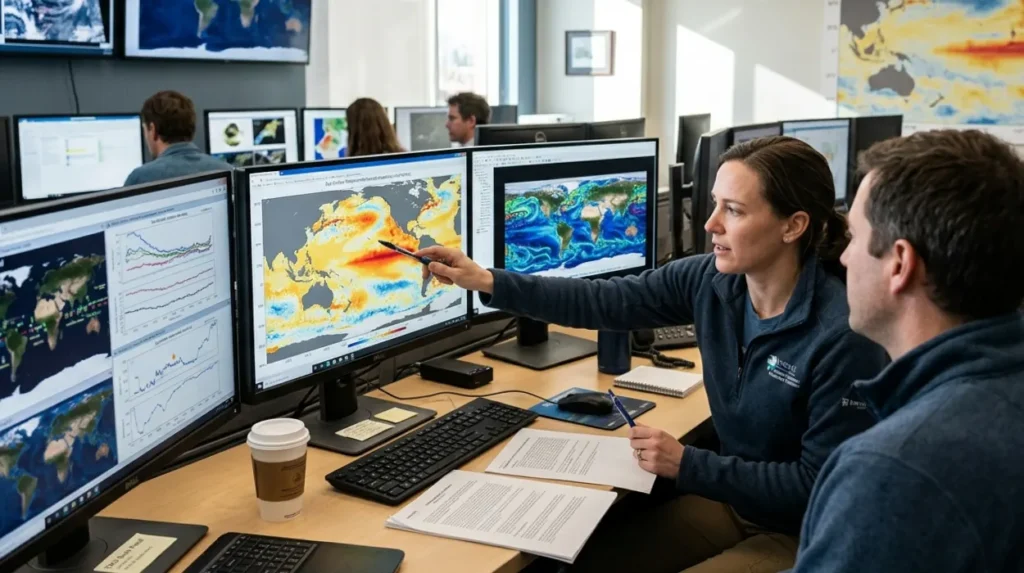
Scientists monitor and predict El Niño developments by collecting real-time oceanic and atmospheric data from three primary tools, including the Tropical Atmosphere Ocean buoy array, orbital weather satellites, and advanced multi-model computer simulations that track sea surface temperature fluctuations.
The tracking of equatorial Pacific climate states relies on a comprehensive global ocean observing system. The foundational element of this system is the Tropical Atmosphere Ocean (TAO) buoy array, which consists of approximately 55 moored ocean buoys deployed across the equatorial Pacific basin. These instruments measure real-time variables at the surface and at specified depths down to 500 meters. The variables recorded by these buoys include four critical metrics: air temperature, relative humidity, wind velocity, and sea surface salinity. Data is transmitted via satellite systems directly to meteorological research centers worldwide, providing immediate insight into subsurface thermal changes.
Orbital weather satellites supplement this in-situ network by providing continuous, wide-area measurements of the global oceans. Satellites use radar altimeters to measure sea surface height anomalies with millimeter-level precision. Because warm water expands, areas with high sea surface heights indicate deep pools of warm water, allowing scientists to track the eastward transit of equatorial Kelvin waves. Infrared and microwave sensors on satellites also map global sea surface temperatures daily, identifying the exact boundaries of the warming anomalies that define the four distinct Niño geographic quadrants:
- Niño 1+2 (the region closest to the South American coast)
- Niño 3 (the eastern equatorial Pacific)
- Niño 3.4 (the central equatorial Pacific)
- Niño 4 (the western equatorial Pacific)
Prediction capabilities utilize two categories of mathematical forecasting models: statistical models and dynamical models. Statistical models use historical data to identify past trends and project current observations forward based on linear relationships. Dynamical models use supercomputers to solve complex fluid dynamics and thermodynamic equations that govern the interactions between the global atmosphere and the oceans. In February 2026, NOAA integrated a new evaluation metric called the Relative Oceanic Niño Index (RONI). The RONI methodology subtracts the long-term warming trend of the global oceans from the localized tropical Pacific anomalies, isolating the true interannual variability of ENSO and reducing data errors caused by global climate change.
What are the historical impacts of strong El Niño events?
Historical records demonstrate that strong El Niño events cause severe environmental disruptions worldwide, resulting in billions of dollars in economic damages due to intense droughts in Australasia and extreme, flood-inducing rainfall across the western Americas.
The historical record documents several extreme El Niño episodes since formal tracking began in 1950. The three most intense events occurred during the periods of 1982–1983, 1997–1998, and 2015–2016. Each of these events altered global weather patterns for over nine months and led to widespread infrastructure damage, agricultural failure, and loss of life. The 1997–1998 event serves as a primary benchmark for climate scientists, as it caused global sea surface temperature anomalies to peak at an unprecedented plus 2.4 degrees Celsius, resulting in global economic losses estimated at 5.7 trillion US dollars.
During the 1982–1983 El Niño, the alteration of the subtropical jet stream led to catastrophic flooding along the west coast of South America and the southern United States. In Peru and Ecuador, rainfall totals exceeded historical averages by 3,000 percent, triggering massive landslides that destroyed transport networks and urban centers. Concurrently, the western Pacific experienced severe drought conditions. Australia suffered its worst drought of the twentieth century, culminating in the Ash Wednesday bushfires of February 1983, which destroyed over 2,000 homes across the states of Victoria and South Australia.
The 2015–2016 El Niño event set records as the hottest calendar year observed up to that date due to the compounding effects of the ocean warming and long-term greenhouse gas accumulation. The event triggered a global coral bleaching phenomenon that affected 93 percent of the Great Barrier Reef in Australia, killing large swathes of marine ecosystems. In Africa, the event caused severe droughts across three geographical zones: East Africa, Southern Africa, and the Horn of Africa. The United Nations Food and Agriculture Organization reported that the resulting crop failures left over 60 million people facing acute food insecurity, requiring international humanitarian assistance.
What are the global weather implications of the latest El Niño forecast?
The latest El Niño forecast will alter global weather patterns by shifting precipitation belts, which increases the likelihood of devastating mudslides in South America while triggering prolonged droughts and heatwaves across Southeast Asia and northern Australia.
The intensification of El Niño through the remainder of 2026 will cause distinct meteorological anomalies across multiple continents. In North America, the modified atmospheric flow will split the polar jet stream, pushing the subtropical jet stream further south. This structural realignment creates a predictable precipitation pattern: the northern tier of the United States and western Canada will experience warmer and drier winter conditions, while the southern tier of the United States, from California to Florida, will receive above-average rainfall and increased storm activity. This shift will alleviate long-term agricultural water shortages in the American Southwest but elevates the immediate risk of flash flooding and structural damage.
In South America, the direct proximity to the warming center of the Niño 1+2 region will cause immediate atmospheric impacts. Peru, Ecuador, and northern Brazil will experience heavy rainfall events that exceed historical baseline metrics. These downpours will cause significant topsoil erosion, impacting major agricultural exports such as coffee and soy. Conversely, the Amazon basin will experience suppressed rainfall, accelerating forest drying trends and increasing the frequency of uncontrolled wildfires. Further south, parts of Argentina and Uruguay will benefit from increased winter precipitation, enhancing local grain yields.
The western edge of the Pacific basin will experience the opposite meteorological extremes. Australia, Indonesia, and the Philippines will face severe rainfall deficits during their traditional monsoon seasons. The WMO rainfall outlook indicates an 80 percent probability of below-normal precipitation across these territories through December 2026. The reduction in rainfall will cause three specific environmental consequences: a reduction in reservoir water storage levels, lower yields for major staple crops such as rice and wheat, and a rapid increase in the regional fire danger index.
In Europe, the impacts remain less direct, though European meteorological organizations track these variations carefully. While the core changes occur in the tropics, historical data shows an increased probability of cold, dry winters in northern regions and wetter, milder conditions across southern areas. In the United Kingdom, forecasters at the London offices of major climate analysis firms note that strong El Niño cycles can interact with the North Atlantic Oscillation, leading to highly variable winter temperatures and altered storm tracks across the British Isles.
What is an El Niño event?
El Niño is the warm phase of the El Niño–Southern Oscillation (ENSO), marked by unusually warm sea surface temperatures in the central and eastern equatorial Pacific Ocean that influence weather patterns around the world.