Greenwich became the Prime Meridian because Britain dominated global navigation, trade, and maritime cartography during the nineteenth century. The Royal Observatory in Greenwich produced the world’s most widely used nautical charts and astronomical data, leading 25 nations to adopt Greenwich as longitude zero in 1884.
- What was the Royal Observatory Greenwich designed to achieve?
- How did Greenwich Mean Time become the world standard?
- What happened at the International Meridian Conference of 1884?
- How did the Prime Meridian affect global navigation and exploration?
- Why does the Prime Meridian line at Greenwich differ from modern GPS measurements?
- Why does Greenwich remain historically important today?
The Prime Meridian is the internationally recognised line of 0 degrees longitude. It divides the Earth into eastern and western hemispheres and forms the basis of global timekeeping. Longitude measures positions east or west across the globe, while latitude measures positions north or south. The Prime Meridian serves as the reference point for navigation, mapping, astronomy, and global coordination systems.
Before international agreements existed, countries used different meridians for maps and navigation. France used Paris. Spain used Madrid. Italy used Rome. The United States used Washington. These competing systems created confusion for shipping, military planning, scientific observation, and international trade.
Greenwich emerged as the leading candidate because Britain controlled the world’s largest maritime empire during the nineteenth century. The British Empire operated major trade routes across the Atlantic Ocean, Indian Ocean, and Pacific Ocean. British naval power connected colonies, ports, and commercial centres across multiple continents.
The decisive institution was the Royal Observatory Greenwich. King Charles II founded the observatory in 1675 to improve navigation at sea. The observatory’s primary purpose was solving the longitude problem, which caused frequent shipwrecks and navigation failures during long-distance voyages.
Astronomers at Greenwich produced highly accurate star charts and astronomical observations. These observations allowed navigators to calculate longitude at sea using celestial measurements. The observatory also published the Nautical Almanack, first issued in 1767. This publication became essential for naval officers and merchant captains worldwide.
By the 1880s, approximately 72 per cent of the world’s maritime commerce used charts based on the Greenwich Meridian. This practical dominance mattered more than politics alone. Countries already depended on British navigation systems, shipping insurance networks, and naval standards.
The international community formally recognised Greenwich during the International Meridian Conference held in Washington, D.C., in October 1884. Delegates from 25 nations voted on a single universal meridian. Greenwich won overwhelmingly because the existing global infrastructure already revolved around British nautical standards.
To experience this historic landmark in person today, consult our comprehensive [What to See at the Royal Observatory in Greenwich] for itineraries and visiting parameters.
What was the Royal Observatory Greenwich designed to achieve?
The Royal Observatory Greenwich was established to improve maritime navigation by producing accurate astronomical observations and solving the problem of determining longitude at sea. Its scientific work transformed navigation, trade safety, naval warfare, and global geographic measurement between the seventeenth and nineteenth centuries.
The longitude problem represented one of the greatest scientific challenges of the early modern period. Sailors could calculate latitude relatively easily by measuring the angle of the Sun or Pole Star. Longitude required precise time measurement, which remained technologically difficult before advanced marine chronometers existed.
When ships miscalculated longitude, fleets drifted hundreds of miles off course. These errors caused naval disasters, commercial losses, and supply failures. Maritime empires depended on accurate navigation because international trade connected distant colonies, military bases, and commercial ports.
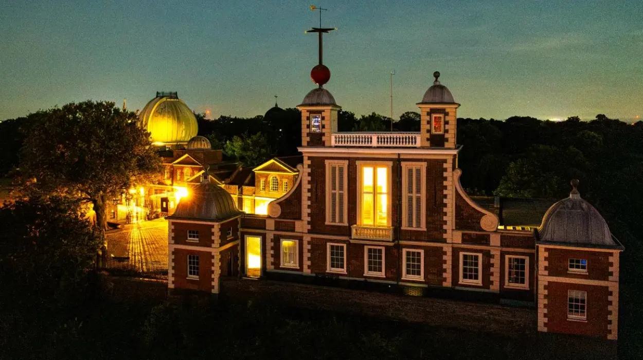
King Charles II created the observatory following advice from leading scientists, including Sir Jonas Moore and Sir Christopher Wren. Construction began in 1675 in Greenwich Park, overlooking the River Thames and London’s maritime districts. The site allowed astronomers clear views of the night sky while remaining close to Britain’s naval administration.
The first Astronomer Royal was John Flamsteed. Flamsteed catalogued thousands of stars with unprecedented precision. His work established a scientific foundation for navigation tables and celestial mapping.
Subsequent Astronomers Royal expanded Greenwich’s international influence. Edmond Halley improved lunar observation systems. George Biddell Airy modernised precision measurement techniques during the nineteenth century.
The observatory introduced increasingly accurate astronomical instruments. These included telescopes, pendulum clocks, sextants, and transit circles. Transit circles measured the exact moment stars crossed the local meridian, enabling astronomers to determine precise local time.
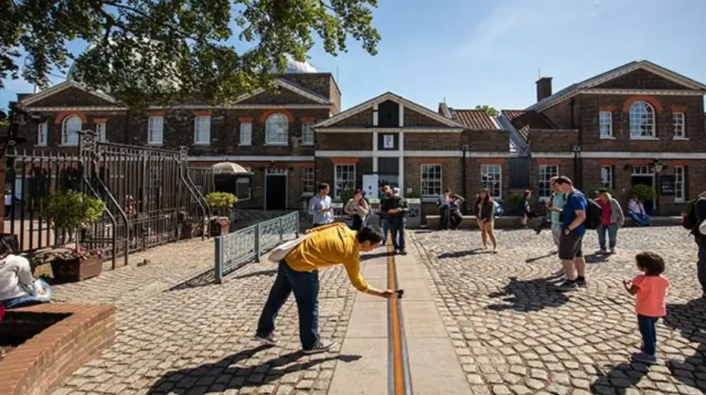
The most important instrument became the Airy Transit Circle, installed in 1851. This telescope defined the Greenwich Meridian later adopted internationally in 1884. Modern visitors standing across the famous metal line at Greenwich stand on the historical Airy Meridian.
Scientific activity at Greenwich also supported the development of chronometers. Inventors such as John Harrison designed marine clocks capable of maintaining accurate time during long ocean voyages. Accurate clocks allowed sailors to compare local solar time with Greenwich Mean Time and calculate longitude precisely.
How did Greenwich Mean Time become the world standard?
Greenwich Mean Time became the international standard because industrialisation, railways, telegraph systems, and maritime trade required synchronised global timekeeping. Britain’s economic influence and the widespread use of Greenwich astronomical data made GMT the practical choice for worldwide coordination during the nineteenth century.
Before standardised time existed, towns operated on local solar time. Noon occurred when the Sun reached its highest point in each location. This system worked in isolated communities but failed during the Industrial Revolution.
Railway networks created major scheduling problems. Cities separated by short distances operated different clocks. For example, Bristol time differed from London time by roughly ten minutes. These inconsistencies caused timetable confusion, missed connections, and operational risks.
Britain’s railway companies gradually adopted London time during the 1840s. Greenwich Mean Time, calculated at the Royal Observatory, became the standard reference. Telegraph networks accelerated this transition because electrical signals could transmit exact time instantly between cities.
GMT eventually extended beyond Britain because global communication required international coordination. Steamships, undersea telegraph cables, and expanding trade routes connected continents more intensively during the nineteenth century.
The International Meridian Conference of 1884 linked the Prime Meridian directly to world timekeeping. Delegates recommended a universal day beginning at midnight at Greenwich. This recommendation standardised navigation, science, meteorology, commerce, and communication.
Modern systems no longer rely entirely on traditional GMT. Coordinated Universal Time, known as UTC, now governs atomic timekeeping. Nevertheless, UTC still references the Prime Meridian established at Greenwich. The historical framework created during the nineteenth century remains central to contemporary global systems.
What happened at the International Meridian Conference of 1884?
The International Meridian Conference of 1884 established Greenwich as the world’s Prime Meridian through an international diplomatic agreement involving 25 nations. The conference standardised longitude and timekeeping systems that remain fundamental to navigation, aviation, telecommunications, and scientific measurement today.
The conference took place in Washington, D.C., from 1 October to 22 October 1884. United States President Chester A. Arthur supported the event because expanding global commerce demanded international standardisation.
Delegates represented countries from Europe, North America, South America, Asia, and the Ottoman Empire. Maritime powers dominated discussions because navigation formed the central concern.
The conference debated several possible meridians. Proposals included Greenwich, Paris, Jerusalem, the Canary Islands, and an Atlantic Ocean line. Greenwich already possessed overwhelming practical advantages due to global shipping patterns.
Delegates examined existing nautical chart usage. Most international shipping already relied on British-produced maps and Greenwich astronomical calculations. Changing systems would have imposed enormous economic costs on governments, shipping companies, and scientific institutions.
The final vote strongly favoured Greenwich. Twenty-two nations supported the proposal. San Domingo voted against it. France and Brazil abstained.
How did the Prime Meridian affect global navigation and exploration?
The Prime Meridian transformed navigation by creating a universal geographic reference system for maps, sea routes, exploration, and military operations. Standardised longitude calculations improved voyage accuracy, reduced shipwrecks, expanded global trade networks, and accelerated scientific mapping during the eighteenth and nineteenth centuries.
Before longitude standardisation, navigators relied heavily on dead reckoning. This method estimated the position using speed, direction, and elapsed time. Errors accumulated rapidly during long voyages, especially across open oceans.
A universal Prime Meridian allowed navigators to compare positions consistently across charts and instruments. Longitude measurements became internationally compatible. This reduced confusion during multinational trade and naval operations.
The British Admiralty played a major role in distributing Greenwich-based charts worldwide. These charts covered oceans, coastlines, harbours, and colonial territories. Merchant fleets and naval squadrons depended on them extensively.
James Cook used advanced astronomical navigation methods during voyages across the Pacific Ocean between 1768 and 1779. His expeditions charted coastlines with unprecedented accuracy and demonstrated the effectiveness of Greenwich-based calculations.
The Prime Meridian later influenced aviation and space exploration. Twentieth-century air routes required precise longitudinal references. Space agencies also adopted Earth-centred coordinate systems derived historically from earlier meridian frameworks.

Why does the Prime Meridian line at Greenwich differ from modern GPS measurements?
Modern GPS systems place the Prime Meridian approximately 102 metres east of the historical Greenwich line because satellite geodesy uses a mathematically calculated Earth-centred reference system, while the original Greenwich Meridian relied on nineteenth-century astronomical observations from the Airy Transit Circle telescope.
Visitors at Greenwich often notice that smartphone GPS readings do not align perfectly with the famous metal meridian line. This discrepancy reflects changes in measurement technology rather than historical error.
The original Greenwich Meridian was defined astronomically. Astronomers measured star positions relative to local vertical gravity at the Royal Observatory. This system worked effectively for nineteenth-century navigation and cartography.
Modern geodesy uses satellite observations and mathematical Earth models. These systems calculate coordinates relative to the Earth’s centre of mass rather than local gravitational conditions. The internationally adopted reference framework is known as the International Reference Meridian.
The difference between the two systems equals roughly 102 metres at Greenwich. Scientific studies confirmed this shift through satellite surveys and geophysical analysis during the late twentieth century.
Why does Greenwich remain historically important today?
Greenwich remains historically important because it established the international systems governing time, longitude, navigation, and global coordination. Its scientific institutions shaped modern geography, communications, transportation, and mapping while preserving major evidence of Britain’s maritime and astronomical heritage.
Modern international systems continue to depend on principles established there. Aviation schedules, satellite navigation, internet synchronisation, telecommunications, and scientific data networks all require standardised time and coordinate systems.
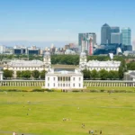
The district also preserves significant architectural heritage. The Royal Observatory, Old Royal Naval College, Queen’s House, and Greenwich Park form one of Europe’s most important historic maritime landscapes.
UNESCO recognised Maritime Greenwich as a World Heritage Site in 1997. The designation includes the Royal Observatory, the Queen’s House, Greenwich Park, and associated maritime buildings. These sites collectively illustrate Britain’s scientific, naval, and imperial history.
Educational institutions continue using Greenwich as a teaching resource for astronomy, geography, navigation, and history. School curricula worldwide reference the Prime Meridian when explaining global coordinates and time zones.
Greenwich remains a major tourism destination because visitors can physically engage with abstract geographic concepts. Standing across the Prime Meridian creates a direct connection between everyday experience and global systems.
Its historical significance extends beyond astronomy alone. Greenwich represents the intersection of science, empire, technology, commerce, and international cooperation. The Prime Meridian passing through Greenwich reflects centuries of scientific work and geopolitical transformation that reshaped the modern world.
What is the Prime Meridian?
The Prime Meridian is the internationally recognised line of 0 degrees longitude that divides the Earth into eastern and western hemispheres. It serves as the global reference point for navigation, mapping, and timekeeping.