Surrey is a ceremonial and non-metropolitan county located in the South East region of England. It borders Greater London to the northeast, Kent to the east, East Sussex to the southeast, West Sussex to the south, Hampshire to the west, and Berkshire to the northwest. The administrative center of the county is Reigate, following the relocation of the Surrey County Council headquarters from Kingston upon Thames in 2020. Surrey spans an area of 1,663 square kilometers and has an estimated population of 1.2 million residents.
- What is the History and Origin of Surrey?
- What are the Main Geographical Features and Ecosystems of Surrey?
- How is the Local Government and Administration of Surrey Structured?
- What Drives the Economy and Infrastructure of Surrey?
- What are the Main Demographic and Educational Characteristics of Surrey?
- What Cultural, Historic, and Natural Landmarks Define Surrey?
- What are the Environmental Challenges and Future Developments for Surrey?
The county exhibits a high level of economic development, containing the highest Gross Value Added (GVA) per capita in the United Kingdom outside of London. It features a diverse landscape characterized by the North Downs chalk ridge, extensive woodland, and rolling lowland vales. Surrey is divided into 11 administrative districts, which comprise boroughs and districts such as Guildford, Waverley, Woking, Reigate and Banstead, Tandridge, Mole Valley, Elmbridge, Runnymede, Spelthorne, Surrey Heath, and Epsom and Ewell.
What is the History and Origin of Surrey?
Surrey originated as a tribal territory in the Anglo-Saxon period before becoming a distinct administrative shire of England. It evolved from an agricultural region into a highly developed, affluent county shaped by its close geographical proximity to London.
The name Surrey derives from the Old English word Suthrige, which translates directly to “southern region” or “the people of the south.” This term designated the territory lying south of the River Thames, opposite the Kingdom of the East Saxons. During the 5th and 6th centuries, the area was settled by various Anglo-Saxon tribes. It fell under the successive control of larger neighboring kingdoms, including Kent, Mercia, and Wessex. In the 9th century, King Alfred the Great integrated Surrey into the Kingdom of Wessex, establishing it as a formal shire.
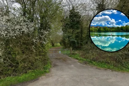
The Domesday Book of 1086 documented Surrey as a predominantly rural landscape divided into 14 hundreds, which were ancient administrative units. These hundreds included areas such as Woking, Godalming, and Farnham. The medieval economy of Surrey relied heavily on agriculture, wool production, and charcoal burning. The county played a significant role in English political history on June 15, 1215, when King John signed the Magna Carta at Runnymede, a meadow located near Egham. This document established the principle that everyone, including the monarch, is subject to the law.
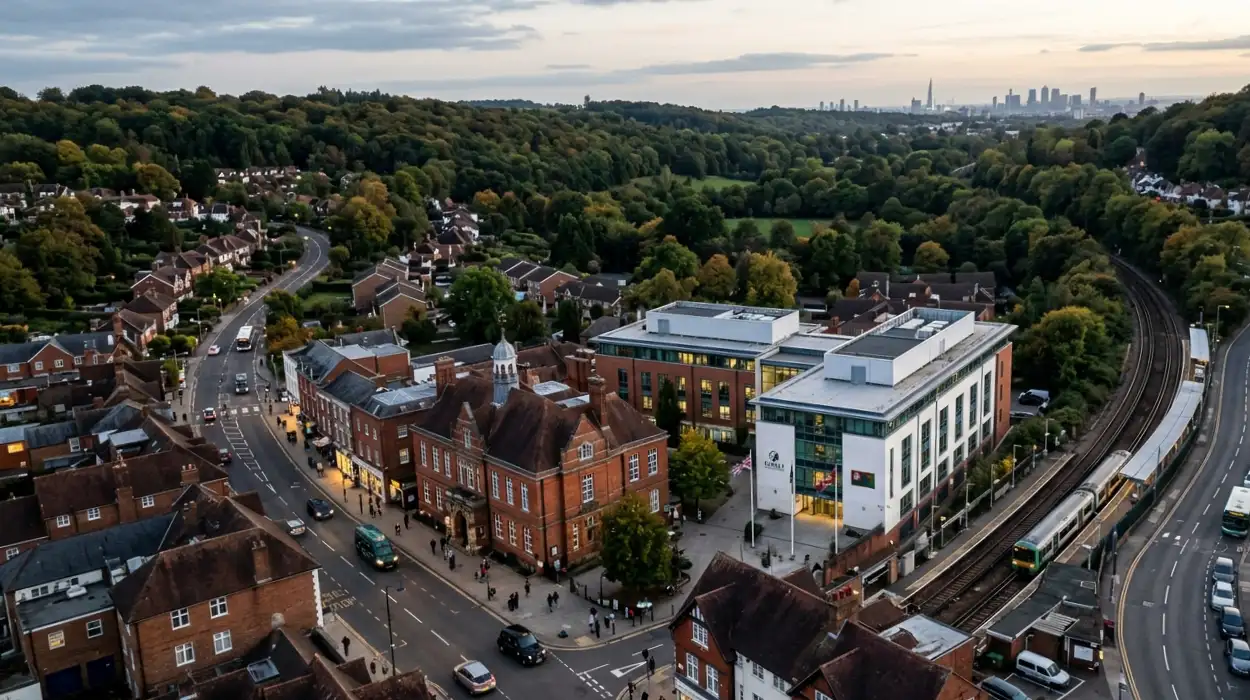
During the Industrial Revolution, the northern sections of Surrey underwent rapid urbanization. The expansion of the railway network in the 19th century transformed towns like Croydon, Kingston upon Thames, and Richmond into affluent commuter suburbs for London workers. The Local Government Act 1888 altered the boundaries of Surrey by transferring these densely populated northern areas to the newly formed County of London. Further boundary changes occurred under the London Government Act 1963, which removed additional boroughs to create Greater London, leaving Surrey with its contemporary geographical boundaries.
What are the Main Geographical Features and Ecosystems of Surrey?
Surrey contains a diverse topography defined by the North Downs chalk ridge, expansive ancient woodlands, and major river systems. The county possesses the highest percentage of woodland coverage of any county in England, measuring 22.4 percent.
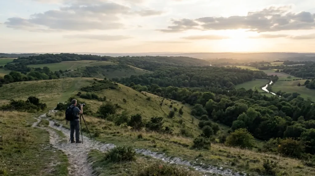
The physical geography of Surrey divides into three distinct east-west bands determined by the underlying geology. The northernmost band consists of London Clay and Bagshot Sands, creating a low-lying terrain that transitions into the Thames Valley. The central band comprises the North Downs, a prominent ridge of chalk hills that extends from Hampshire across Surrey to Kent. This ridge includes Box Hill, which rises to 224 meters above sea level, and Leith Hill, the highest point in southeastern England at 294 meters above sea level. The southernmost band features the Low Weald, a lowland region composed of clay and sandstone.
The river systems of Surrey drain primarily into the River Thames, which forms part of the northern border of the county. The two principal tributaries are the River Wey and the River Mole. The River Wey flows northward through Alton, Farnham, and Guildford before joining the Thames at Weybridge. The River Mole cuts through the North Downs chalk ridge at the Mole Gap between Dorking and Leatherhead, eventually emptying into the Thames at Hampton Court. These rivers support distinct wetland habitats and historically powered watermills for industrial use.
Surrey contains extensive forested areas, with woodlands covering more than one-fifth of its total landmass. This coverage represents more than double the national average for England, which stands at 10 percent. The county features large expanses of heathland, such as Thursley Common, Chobham Common, and Frensham Common. These areas provide habitats for rare wildlife species, including the sand lizard (Lacerta agilis), the smooth snake (Coronella austriaca), and the nightjar (Caprimulgus europaeus). The Surrey Hills Area of Outstanding Natural Beauty (AONB) covers 422 square kilometers, protecting these landscapes from urban development.
How is the Local Government and Administration of Surrey Structured?
Surrey operates under a two-tier local government system consisting of a county council and 11 distinct borough and district councils. This framework manages public services, urban planning, infrastructure development, and financial resource allocation across the region.
The overarching administrative body is the Surrey County Council, which maintains its headquarters at Woodhatch Place in Reigate. The county council consists of 81 elected councillors, each representing a specific electoral division for a four-year term. The county council holds responsibility for large-scale, strategic public services across the entire county. These responsibilities encompass strategic transport planning, highways maintenance, education services, social care for adults and children, waste disposal operations, and the management of the Surrey Fire and Rescue Service.
The second tier of local government comprises 11 lower-tier authorities, which divide into districts and boroughs. These authorities consist of Elmbridge Borough Council, Epsom and Ewell Borough Council, Guildford Borough Council, Mole Valley District Council, Reigate and Banstead Borough Council, Runnymede Borough Council, Spelthorne Borough Council, Surrey Heath Borough Council, Tandridge District Council, Waverley Borough Council, and Woking Borough Council. These local councils manage localized public services, including domestic waste collection, local housing provision, environmental health enforcement, and the administration of local parks.
Urban planning responsibilities divide between the two tiers of government. The 11 district and borough councils determine local planning applications, designate local conservation areas, and formulate Local Plans that guide housing allocations. The Surrey County Council determines planning applications relating to mineral extraction, waste management facilities, and major educational or highway developments. For Westminster parliamentary elections, Surrey divides into 12 parliamentary constituencies, each electing one Member of Parliament (MP) to the House of Commons.
What Drives the Economy and Infrastructure of Surrey?
The economy of Surrey relies on professional services, technology firms, healthcare organizations, and corporate headquarters. Excellent transport infrastructure links the county directly to London, the rest of the United Kingdom, and international aviation hubs.
The economy of Surrey generates a Gross Value Added (GVA) exceeding £40 billion annually. The county lacks a major heavy industrial sector, focusing instead on service industries, technology, pharmaceuticals, and corporate administration. Major multinational corporations maintain their United Kingdom or European headquarters within Surrey due to its proximity to London. These corporations include Unilever in Kingston-upon-Thames, McLaren Group in Woking, Toyota in Burgh Heath, and Samsung Electronics in Chertsey. The technology sector employs over 25,000 people across the county.
The transport infrastructure of Surrey features an extensive network of motorways, trunk roads, and radial railway lines. The M25 motorway, an orbital road surrounding London, passes through the center of the county, intersecting with the M3 motorway at Chertsey and the M23 motorway near Merstham. These intersections connect Surrey to London Heathrow Airport, located immediately northwest of Spelthorne, and London Gatwick Airport, situated adjacent to the southern border near Horley. The A3 trunk road provides a direct dual-carriageway link between London and the south coast at Portsmouth.
The rail network in Surrey operates predominantly on a radial layout centered on London Waterloo and London Victoria stations. The South Western Main Line serves major towns including Woking, Guildford, and Weybridge, providing rapid commuter transit into central London. The Brighton Main Line cuts through the eastern portion of the county, serving Redhill and Reigate. Cross-country rail infrastructure includes the North Downs Line, which connects Reading, Guildford, Dorking, Redhill, and Gatwick Airport, facilitating east-west orbital travel without entering the London transport zones.
What are the Main Demographic and Educational Characteristics of Surrey?
Surrey possesses a population characterized by high levels of formal education, above-average life expectancy, and higher median household incomes than the national average. Its educational infrastructure contains top-performing schools and major research universities.
The population of Surrey reached approximately 1.2 million residents according to official demographic data. The county exhibits a population density of 720 people per square kilometer, which is significantly higher than the average density for England. The population distribution concentrates in the northern and western urban areas, such as Woking and Guildford, while the southern areas remain rural. Demographically, the county has an aging population, with the proportion of residents aged 65 and over increasing faster than the national average.
The educational infrastructure of Surrey includes both state-funded and independent institutions. The county manages 395 state-funded primary, secondary, and special schools through its local authority framework. Surrey contains a high concentration of independent schools, including Charterhouse School in Godalming, Cranleigh School in Cranleigh, and Epsom College in Epsom. Students in Surrey consistently achieve higher average grades in General Certificate of Secondary Education (GCSE) and A-Level examinations than the national averages for England.
Higher education in Surrey features major research institutions and specialist colleges. The University of Surrey, based in Guildford, enrolls over 16,000 students and specializes in electronic engineering, satellite technology, and veterinary medicine. Royal Holloway, University of London, is located in Egham and is renowned for its science, arts, and humanities faculties. Specialist institutions include the University for the Creative Arts (UCA) with campuses in Farnham and Epsom, and the University of Law in Guildford, which provides professional legal training.

What Cultural, Historic, and Natural Landmarks Define Surrey?
Surrey contains numerous cultural landmarks, historic royal palaces, and protected natural spaces that attract millions of international visitors annually. These locations preserve the architectural heritage and ecological diversity of southeastern England.
The historic architectural landmarks of Surrey span several centuries of English history. Hampton Court Palace, though administratively within the London Borough of Richmond upon Thames, sits historically on the border of Surrey and remains deeply tied to the heritage of the county. Within the modern county borders lies Loseley Park, a 16th-century manor house built with stone from the ruins of Waverley Abbey. Clandon Park and Hatchlands Park are notable 18th-century stately homes managed by the National Trust, exhibiting Palladian and neoclassical architecture.
Surrey features major horticultural and botanical centers of international significance. Royal Horticultural Society (RHS) Garden Wisley covers 240 acres and serves as the flagship garden of the RHS, housing large plant collections and scientific research laboratories. The Royal Botanic Gardens, Kew, maintains a secondary site at Wakehurst on the Sussex border, but its historical links to Surrey estates remain strong. Painshill Park in Cobham represents one of the finest surviving examples of an 18th-century English landscape garden, featuring a crystal grotto and artificial lakes.
The county contains ancient religious ruins and commemorative monuments. Waverley Abbey, founded in 1128 near Farnham, was the first Cistercian monastery established in England. The ruins are managed by English Heritage. At Runnymede, the Magna Carta Memorial, designed by Sir Edward Maufe and erected by the American Bar Association in 1957, stands alongside the John F. Kennedy Memorial and the Air Forces Memorial, which honors 20,456 Commonwealth airmen who died in World War II without a known grave.
What are the Environmental Challenges and Future Developments for Surrey?
Surrey faces significant environmental challenges regarding urban development pressures, green belt protection, and carbon emission reductions. Future development strategies prioritize sustainable infrastructure, renewable energy adoption, and biodiversity preservation.
The conflict between housing demand and environmental conservation represents a critical issue for local planning authorities in Surrey. Approximately 73 percent of the land in Surrey falls within the Metropolitan Green Belt, a planning designation designed to prevent urban sprawl by restricting development around London. This restriction limits the availability of land for new housing projects, leading to high property prices and increased development density within existing urban boundaries. Local councils must balance national housing targets against the statutory protection of the Green Belt.
Climate change adaptation forms a core component of the long-term planning strategy of the Surrey County Council. The authority declared a climate emergency and committed to achieving net-zero carbon emissions as an organization by 2030, and across the entire county by 2050. To achieve these goals, the council implemented infrastructure programs, including the installation of public electric vehicle charging points and the conversion of the public bus fleet to zero-emission electric and hydrogen vehicles.
The management of flood risk is another priority due to the proximity of major river valleys. The River Thames Scheme, developed in partnership with the Environment Agency, represents a major infrastructure project designed to reduce flood risk for thousands of homes in Surrey communities such as Staines-upon-Thames, Egham, and Chertsey. This scheme involves construction of new flood channels, capacity improvements to existing waterways, and creation of new green spaces to manage excess rainwater, ensuring the long-term resilience of the county.
Where is Surrey located?
Surrey is a ceremonial and non-metropolitan county in South East England. It borders Greater London, Kent, East Sussex, West Sussex, Hampshire, and Berkshire, making it one of the counties surrounding London.