Key Points
- Event Date and Timing: The Arsenal open-top bus victory parade is officially confirmed to take place on Sunday, May 31, 2026, commencing promptly at 2:00 pm BST, with rolling road closures persisting until approximately 8:00 pm BST.
- Historic Milestone: The celebration honours Arsenal securing their first Premier League title in 22 years, alongside the successes of the women’s team, who clinched the FIFA Women’s Champions Cup.
- Potential Dual Trophies: The parade takes place less than 24 hours after the men’s team competes in the UEFA Champions League final on Saturday, May 30, raising the possibility of a dual-trophy presentation.
- Unprecedented Crowd Expectations: Municipal and club authorities are anticipating a minimum turnout of 500,000 supporters, though structural planning accounts for significantly higher attendance numbers across North London.
- Unique Joint Parade: In a historic first for the club, the procession will feature both the men’s and women’s senior squads sharing the celebratory open-top buses.
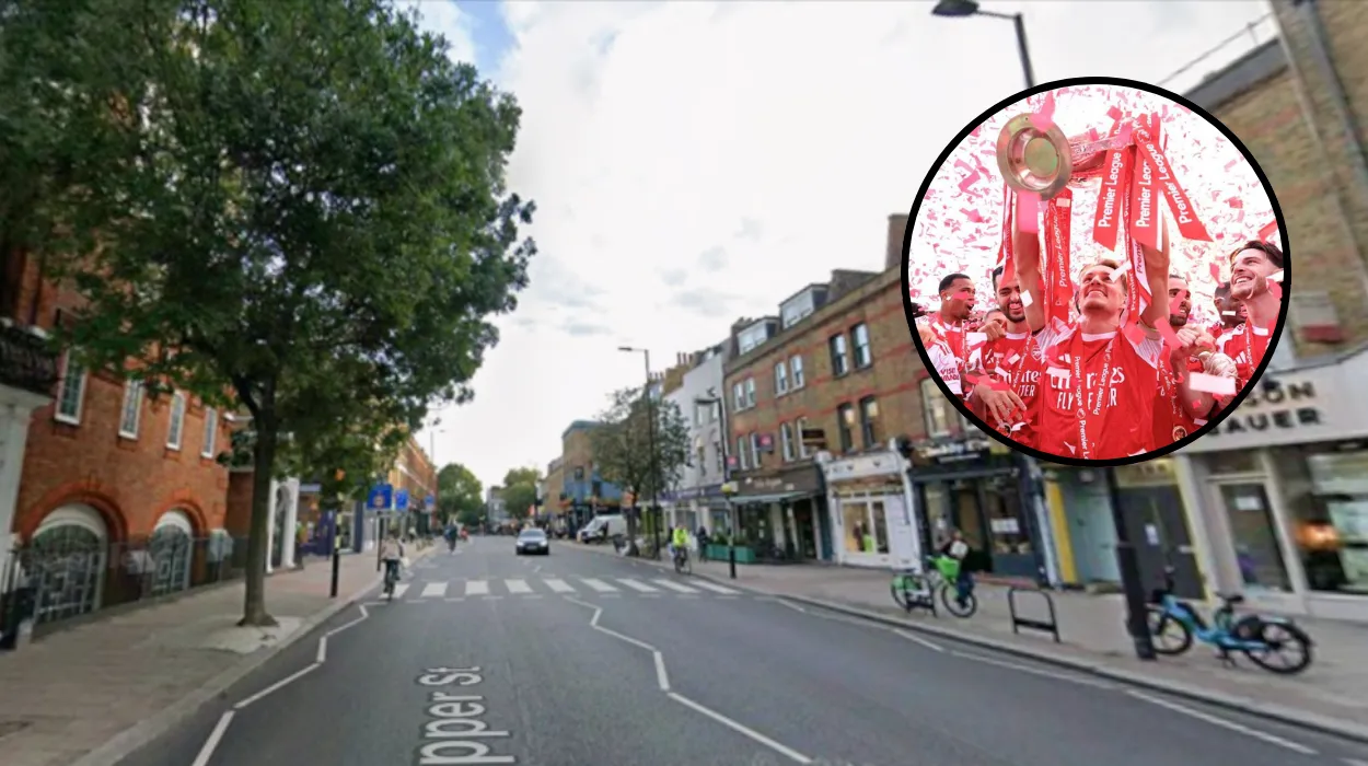
- Comprehensive 9km Procession Route: The continuous 9-kilometre transit path encompasses major arteries including Holloway Road, Seven Sisters Road, Blackstock Road, Newington Green, Essex Road, and Upper Street.
- Crucial Emirates Stadium Exclusion: Club officials have verified that the parade route does not pass directly by the Emirates Stadium. The stadium itself and immediate perimeter zones—including Drayton Park, Hornsey Road, and Benwell Road—are strictly closed to gathering fans.
- Severe Municipal Disruption: Islington Council has ordered extensive road closures starting from 4:00 am BST, total parking suspensions along the route, the temporary removal of Low Traffic Neighbourhood (LTN) filters, and the complete Sunday closure of multiple public parks, green spaces, and libraries.
London (Extra London News) May 30, 2026 — Arsenal Football Club and Islington municipal authorities have finalized comprehensive operational plans for a massive open-top bus victory parade scheduled for Sunday, May 31, 2026, to celebrate a historic sporting campaign. The parade, set to begin at 2:00 pm BST, will honour Mikel Arteta’s senior men’s squad for capturing their first Premier League trophy in 22 years, alongside Jonas Eidevall’s women’s team, celebrating their FIFA Women’s Champions League triumph. Depending on the outcome of the UEFA Champions League final held on Saturday evening, May 30, the men’s squad may also display European club football’s ultimate prize. Local government administrators expect an unprecedented minimum crowd of 500,000 people to flood the streets of North London, prompting extensive road closures, transit diversions, and strict safety protocols across the Borough of Islington.
- Key Points
- What Are the Confirmed Timings and Crowd Forecasts for the Event?
- What is the precise route of the 9km Open-Top Bus Procession?
- Which Major Roads and Side Streets Face Total Closure?
- When Do the Traffic Restrictions Take Effect?
- Which Specific Islington and Hackney Streets Are Affected?
- How Will Local Infrastructure and Public Facilities Be Impacted?
- Which Parks and Civic Spaces Will Be Completely Shut?
- What Are the Temporary Changes to Low Traffic Neighbourhoods (LTNs)?
- What Travel Advice and Safety Guidelines Have Authorities Issued?
What Are the Confirmed Timings and Crowd Forecasts for the Event?
As detailed in an official club statement published by the Arsenal Media Team on the official Arsenal website, the “Champions Parade” is scheduled to assemble and depart at 2:00 pm BST on Sunday, May 31, 2026. Club executives have emphasised that this event serves as the culmination of an unforgettable week for the global Arsenal community. The timing of the procession creates an incredibly tight operational turnaround for metropolitan police and emergency services, occurring less than 24 hours after the conclusion of the UEFA Champions League final.
Writing for MyLondon, regional reporter Matt Spivey noted that the event is mathematically modelled to attract a baseline crowd of half a million individuals, though internal municipal projections suggest the actual turnout could significantly exceed this figure. The unprecedented nature of the dual-team celebration, combined with the end of a multi-decade top-flight title drought for the men’s team, has forced emergency services to brace for historical attendance levels along the entire transit corridor.
What is the precise route of the 9km Open-Top Bus Procession?
Where Does the Parade Start and End?
According to structural mapping verified by Time Out London, the parade route stretches for a continuous nine kilometres through the heart of the club’s home borough. While the technical staging and security cordons will be initiated near the Emirates Stadium infrastructure, the club has taken the unusual step of routing the open-top buses entirely away from the immediate perimeter of the ground.
As explicitly detailed by the MyLondon editorial team, the public procession starts at 2:00 pm BST and proceeds systematically up Holloway Road. From there, the convoy maneuvers around the Seven Sisters junction before tracking down Blackstock Road. The buses will then navigate onto Newington Green, proceed entirely down the length of Essex Road, execute a right turn at Angel Underground Station, and travel up the expansive thoroughfare of Upper Street before drawing to a conclusion.
Why Are Fans Barred from Gathering Near the Emirates Stadium?
In a strongly worded advisory issued directly by Arsenal Football Club management, supporters have been explicitly warned that the traditional stadium grounds will offer zero visibility of the team. The statement reads:
“Access to the stadium is closed to fans, and there won’t be any space to gather around Drayton Park, Hornsey Road, and Benwell Road, as you will not be able to see the team from those locations.”
Club administrators explained that the Emirates Stadium is hosting an official large-screen viewing event for the Champions League final on Saturday night. Consequently, massive security deconstruction and parade staging operations will be occurring concurrently on Sunday morning.
The official Arsenal statement further warned that any unsanctioned fan gatherings around the stadium perimeter on Saturday evening or Sunday morning “may significantly impact our preparation for, and ability to deliver, the parade celebrations.”
Furthermore, as reported by journalists covering the event for MyLondon, the buses will remain in continuous motion throughout the 9km journey. Unlike previous historical iterations in 1998, 2002, and 2004, there will be no static trophy lifts or staged balcony presentations at the stadium or municipal town halls.
Explore More Islington News
Wahaca Launches Arsenal Title Discount in Islington 2026
Masaj Opens New Luxury Wellness Studio in Islington Square 2026
Which Major Roads and Side Streets Face Total Closure?
When Do the Traffic Restrictions Take Effect?
The Islington Council Transport Secretariat has issued a comprehensive decree mandating that formal road closures will commence at 4:00 am BST on Sunday, May 31, 2026. The local government expects these closures to remain strictly in place until at least 8:00 pm BST, though highways engineers have warned that closures could be extended later into the night depending entirely on the time required to safely disperse the massive crowds and clear debris.
Which Specific Islington and Hackney Streets Are Affected?
Public safety notices published by Islington Council and verified by Time Out London confirm that all roads directly constituting the parade route, alongside every single secondary side road feeding into the main transit line, will be entirely blocked to vehicular traffic.
The comprehensive list of affected thoroughfares within the Borough of Islington includes:
- Primary Arteries: Holloway Road (between Tufnell Park Road and Highbury Corner), Essex Road, and Upper Street.
- Secondary Staging Roads: Almeida Street, Ambler Road (between Blackstock Road and No. 24), Arvon Road (between Drayton Park and Witherington Road), Ashby Grove (between Essex Road and Red House Square), and Athenaeum Court (between Petherton Road and Nos. 31–32 Orwell Court).
- Connecting Grid Streets: Axminster Road (between Seven Sisters Road and Windsor Road), Balls Pond Road (between Newington Green Road and Henshall Street), Barnsbury Street (between Upper Street and College Cross), Battishill Street, Benwell Road (between Drayton Park and Bryantwood Road), Beresford Road, Beresford Terrace, Berners Road, and Berriman Road (between Seven Sisters Road and No. 44).
- Extended Transport Corridors: Biddestone Road (between Caledonian Road and the Loraine Estate access road), Bingham Street, Blackstock Road (between Seven Sisters Road and No. 164), Bowman’s Mews, Britannia Row (between Essex Road and Terling Walk), Bryantwood Road, Caledonian Road (between Camden Road and No. 570), Camden Passage, Camden Road (between Holloway Road and No. 353), and Camden Walk.
- Residential Feeder Links: Canning Road, Canonbury Lane, Canonbury Road, Canonbury Street, Catherall Road, Charlton Place, Chatterton Road, Chillingworth Road, Church Road, Clephane Road, Colebrooke Place, Colebrooke Row, Coleridge Road, Collins Road, Compton Terrace, Corsica Street, Crane Grove, Cross Street, Dibden Street, Digswell Street, Dove Road, Drayton Park (between Holloway Road and No. 68), Durham Road, Eburne Road, Eden Grove, Elder Walk, Elliott’s Place, Elmore Street, Englefield Road, Esther Anne Place, Ferntower Road, Fieldway Crescent, Florence Street, Fonthill Road, Furlong Road, Gaskin Street, Georges Road, Gillespie Road, and外 Goodwin Street.
Simultaneously, because the parade boundary skims the western edge of the Borough of Hackney, the Hackney Local Authority has enacted parallel closures. As reported by Time Out London, these involve:
- Brownswood Road (between Blackstock Road and Finsbury Park Road).
- Finsbury Park Road (between Mountgrove Road and No. 107).
- Green Lanes (including the Arakan House entry road and the segment between Queen’s Drive and No. 141).
- King’s Crescent (between Mountgrove Road and No. 29).
- Mountgrove Road.
- Riversdale Road (between Green Lanes and No. 84).
- Somerfield Road, Statham Grove, Stoke Newington Church Street (between Green Lanes and Clissold Crescent), and Wilberforce Road.
How Will Local Infrastructure and Public Facilities Be Impacted?
Which Parks and Civic Spaces Will Be Completely Shut?
An extraordinary measure taken by Islington Council involves the complete lockdown of all public green spaces, civic gardens, and leisure infrastructure situated anywhere near the 9km parade vector. In an official briefing to local businesses and residents, the Islington Council Executive stated that these closures are mandatory to preserve public safety, prevent the structural destruction of historical gardens, and avoid dangerous crowd crushing inside enclosed walls.
The public parks and civic facilities confirmed to be completely closed on Sunday include:
- Major Parks and Reserves: Gillespie Park, Islington Green, and the New River Walk.
- Civic Gardens and Squares: Canonbury Square, Canonbury Gardens, Compton Terrace, Colebrooke Row, St Mary’s Church Garden, and St Mary Magdalen Church Gardens.
- Local Enclaves: Astey Row, Battishill Street Gardens, Biddestone Road, Dibden Street Triangle, Duncan Terrace, Gibson Square, Kinlock Gardens, Milner Square, Pleasant Place, St Pauls Shrubbery, and St Pauls South.
Additionally, the borough’s flagship literary institution, the Central Library on Holloway Road, will remain entirely locked and unstaffed throughout Sunday.
What Are the Temporary Changes to Low Traffic Neighbourhoods (LTNs)?
To accommodate the displacement of essential emergency service vehicles and prevent total gridlock on peripheral arterial roads, Islington Council has announced the temporary suspension of traffic filters within several prominent Low Traffic Neighbourhoods (LTNs).
According to the council’s published infrastructure plan, traffic enforcement cameras and physical filters will be temporarily deactivated or bypassed in the following zones:
- Canonbury East
- Canonbury West
- Highbury
- St Mary’s Church
- St Peter’s
In addition to these community-wide zones, municipal authorities are removing the active traffic filters outside the Sacred Heart Catholic Primary School. Furthermore, on Britannia Row—specifically the section running between Popham Street and Windsor Street—the council is legally altering the highway layout, allowing residents to temporarily travel in both directions instead of the legally mandated one-way restriction.
What Travel Advice and Safety Guidelines Have Authorities Issued?
How Should Supporters Plan Their Public Transport Journey?
Transport for London (TfL) has issued an urgent advisory detailing extensive disruption across the underground and overground rail networks. Due to the high volume of foot traffic anticipated at transit hubs intersecting the parade route, specific stations will implement strict crowd-control measures.
TfL engineers have confirmed that Highbury & Islington Station, Angel Station, and Holloway Road Station will experience rolling entrance closures to prevent platform overcrowding. Crucially, the Canonbury Overground Station will operate on a strict “exit-only” system for the duration of the afternoon, preventing passengers from entering the station at that location following the conclusion of the parade.
A TfL regional operational manager stated:
“We strongly urge all football supporters and casual travellers to completely avoid driving anywhere near the wider North London quadrant. Public transport networks will be severely stretched, and commuters must factor in significant delays when navigating the network.”
How Can Vulnerable Communities and Local Businesses Prepare?
In the club’s comprehensive safety briefing, Arsenal management made a direct appeal to the civilian population to maintain order and consideration for vulnerable fans. The club’s safety liaison officer noted:
“Our parade will draw a massive multi-generational turnout, and the safety and well-being of all our supporters is our highest priority. We explicitly ask that attendees are deeply mindful of younger supporters, families, and our disabled communities who will be positioned along the barriers, and equally considerate of local residents and businesses throughout the afternoon.”
Local businesses along Upper Street and Holloway Road have been advised by the Islington Chamber of Commerce to expect immense footfall but total restrictions on commercial deliveries. All storefronts have been urged to secure their external perimeters and coordinate with council street-cleaning teams, who will begin a massive reclamation operation alongside the police as the rolling roadblocks move through the borough.